


When it comes to protecting the state from sea-level rise, Georgia is a step ahead of the rest thanks to a piece of legislation celebrating its 50th anniversary this year.
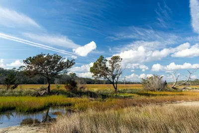
One hundred miles of coastal salt marsh along the Georgia coast is an integral part of the fabric of the state's identity, wildlife habitat, and natural landscape. Fifty years since a Georgia law was passed to protect the marsh, residents know that the 400,000 acres of tall grasses and shallow, muddy waters are appreciated and secure.
But this wasn't always the case, says Molly Samuel. "The marsh’s value and its beauty might be taken for granted now, but in the late-1960s, there was a proposal to mine Georgia’s salt marsh. To dig it up, then fill it in."
The legislation would later prove itself to be vital to the states future as sea-level rise threatening costal communities in the United States and beyond. Georgia's marshes make up about a third of salt marshland on the Eastern Seaboard, an indispensable buffer between land and sea.
Samuel recounts the history of Coastal Marshlands Protection Act. The desire to develop Georgia's 12 islands "largely owned by wealthy families that used them as vacation destinations" and a phosphate mining proposal turned out the masses during a state hearing on the matter.
Fifty years later, Georgia has a new beast to tackle. "On the Georgia coast, sea levels are getting higher by a little over a tenth of an inch a year, adding up to close to a foot a century," writes Samuel.
Experts say that as the sea-level rises, the marshlands will inch inland. "Georgia is working on ways to adapt to and prepare for increasingly high tides, asking local governments to plan for sea level rise, and protecting open space so that the marshes can keep moving inland," Samuel says.
FULL STORY: How Georgia Protected Its Salt Marsh 50 Years Ago, And Why That’s Important For The Future

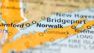
Mixed-Use Zoning in Waterfront Plan Attracts Controversy in Connecticut
Norwalk, Connecticut is figuring out how to balance the competing interests of development demand, public access, environmental risks, and historic preservation.
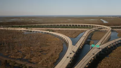
$50 Billion Coastal Master Plan Updated in Louisiana
Louisiana is losing coastal lands, quickly, along with the habitat and economic resources located there. A Coastal Master Plan plots $50 billion in spending to protect the coast.
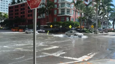
Florida Home Insurance Prices Increasingly a Burden for Residents
Climate change is coming for the state of Florida, and it’s already showing up in the insurance market.

Alabama: Trump Terminates Settlements for Black Communities Harmed By Raw Sewage
Trump deemed the landmark civil rights agreement “illegal DEI and environmental justice policy.”

Planetizen Federal Action Tracker
A weekly monitor of how Trump’s orders and actions are impacting planners and planning in America.

The 120 Year Old Tiny Home Villages That Sheltered San Francisco’s Earthquake Refugees
More than a century ago, San Francisco mobilized to house thousands of residents displaced by the 1906 earthquake. Could their strategy offer a model for the present?

Ken Jennings Launches Transit Web Series
The Jeopardy champ wants you to ride public transit.

BLM To Rescind Public Lands Rule
The change will downgrade conservation, once again putting federal land at risk for mining and other extractive uses.

Indy Neighborhood Group Builds Temporary Multi-Use Path
Community members, aided in part by funding from the city, repurposed a vehicle lane to create a protected bike and pedestrian path for the summer season.
Urban Design for Planners 1: Software Tools
This six-course series explores essential urban design concepts using open source software and equips planners with the tools they need to participate fully in the urban design process.
Planning for Universal Design
Learn the tools for implementing Universal Design in planning regulations.
Clanton & Associates, Inc.
Jessamine County Fiscal Court
Institute for Housing and Urban Development Studies (IHS)
City of Grandview
Harvard GSD Executive Education
Toledo-Lucas County Plan Commissions
Salt Lake City
NYU Wagner Graduate School of Public Service