


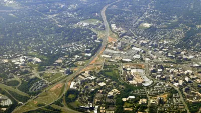
Ten years after Tysons, an unincorporated community in Fairfax County, Virginia, approved an award winning comprehensive plan, there's still work to be done to achieve its ambitious goals.
Emily Hamilton, a research fellow and director of the Mercatus Center at George Mason University’s Urbanity Project, checks in with the status of the transformation of Tysons ten years after the city adopted a comprehensive plan to take advantage of the arrival of light rail transit and a growing residential population in this corner of Fairfax County of Northern Virginia.
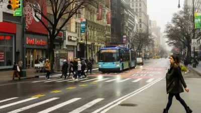
According to Hamilton's assessment, Tysons has work to do to achieve the goals set forth in the plan. "The plan was heralded by the American Planning Association for seeking to transform a sprawling, highway-oriented area into a series of transit-oriented, walkable neighborhoods. So far, for all its progress, it has not ushered in an era of easy walkability," according to Hamilton. (The Tysons Comprehensive Plan earned the 2011 Daniel Burnham Award for a Comprehensive Plan from the American Planning Association.)
This is the second article by Hamilton evaluating the progress of the Tysons Comprehensive Plan. In the first article, Hamilton focused on the effect on walkability from the wave of new residential development in Tysons since 2010. This latest article focuses on the transportation planning choices that have limited the success of the plan:
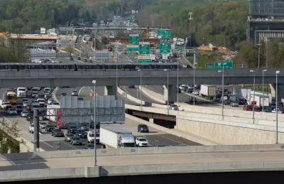
A freeway and multiple major arterial roads cut through Tysons. The comprehensive plan calls for slowing cars down and transforming the arterials into tree-lined boulevards with wide sidewalks and medians that would make them safe for pedestrians.
At the same time, the plan promised to maintain commute times for drivers going to or through Tysons. To this end, policymakers have actually widened some Tysons arterials rather than making major improvements to them for walkers. To cross parts of Route 123, walkers have to traverse 12 lanes of traffic.
Still, according to Hamilton, the Tysons Comprehensive Plan was set up to succeed, and it's still possible to achieve all of the ambitious goals included in the plan.
FULL STORY: Ten years into redevelopment, is Tysons what we envisioned?

Survey Says New Yorker Want More Protected Bike and Bus Lanes, Less Parking
A new survey reveals broad support for a less car-centric approach to capital investment in the city of New York.
The Great Retrofit: Transforming Tysons With Walkable Residential Development
A 2010 comprehensive plan set a goal to add 100,000 residential units with walkable access to public transit to this unincorporated corner of Fairfax County in Northern Virginia.
‘Stroads:’ The Worst of Both Worlds
An urban planning critic says the U.S. should build streets for people to live on, and roads to move traffic quickly.

Alabama: Trump Terminates Settlements for Black Communities Harmed By Raw Sewage
Trump deemed the landmark civil rights agreement “illegal DEI and environmental justice policy.”

Planetizen Federal Action Tracker
A weekly monitor of how Trump’s orders and actions are impacting planners and planning in America.

The 120 Year Old Tiny Home Villages That Sheltered San Francisco’s Earthquake Refugees
More than a century ago, San Francisco mobilized to house thousands of residents displaced by the 1906 earthquake. Could their strategy offer a model for the present?

Ken Jennings Launches Transit Web Series
The Jeopardy champ wants you to ride public transit.

BLM To Rescind Public Lands Rule
The change will downgrade conservation, once again putting federal land at risk for mining and other extractive uses.

Indy Neighborhood Group Builds Temporary Multi-Use Path
Community members, aided in part by funding from the city, repurposed a vehicle lane to create a protected bike and pedestrian path for the summer season.
Urban Design for Planners 1: Software Tools
This six-course series explores essential urban design concepts using open source software and equips planners with the tools they need to participate fully in the urban design process.
Planning for Universal Design
Learn the tools for implementing Universal Design in planning regulations.
Clanton & Associates, Inc.
Jessamine County Fiscal Court
Institute for Housing and Urban Development Studies (IHS)
City of Grandview
Harvard GSD Executive Education
Toledo-Lucas County Plan Commissions
Salt Lake City
NYU Wagner Graduate School of Public Service