


An analysis of Lime bikeshare data from Boston suburbs is providing useful information about travel behavior and trends.
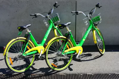
"The Metropolitan Area Planning Council facilitated contracts between multiple Boston suburbs and Lime, a bike-sharing company, and received anonymized data on 300,000 trips as part of an agreement with the company," reports Andy Metzger. MAPC released a research brief with analysis of the 18 months of data about dockless bikeshare in the metropolitan Boston area.
"According to the data, about 18 percent of miles traveled by Lime bikers were on stretches classified as 'very high stress' – roadways where the lane configurations and traffic make them especially risky for bike-car crashes," writes Metzger. The findings also indicate that about 44 percent of Lime trips are happening on multiuse paths, and riders’ destinations include a mix of urban centers, residential areas, and transit stops.
The agency says its analysis of Lime travel data will help guide future planning efforts and development of safe infrastructure and strategies to encourage non-auto travel. "Asserting that similar data-sharing arrangements should be standard for all new mobility forms – including scooters, autonomous vehicles, and drones – MAPC plans to keep crunching the numbers," adds Metzger.
FULL STORY: Lime riders traverse dangerous roadways

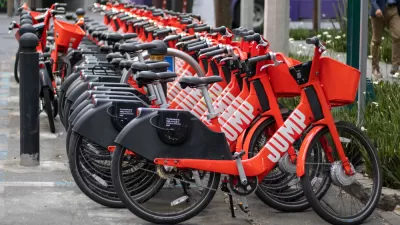
The Fall of JUMP Bikes
An exposé of the dramatic rise and fall of JUMP bikes under the ownership of Uber, in partnership with cities all over the United States.

Boston's Bikeshare System Gets a New Partner, Rebranding
Blue Cross will pay $18 million for a six-year sponsorship of the Boston-area bikeshare system formerly known as Hubway.
Multiple Studies Find Ride-Hailing Contributes to Congestion and Transit Losses
Surveys on ride-hailing conducted by regional planning agencies, academic institutions, and public transit agencies throughout the U.S. reviewed by the Associated Press largely led to the same conclusion: more traffic and reduced use of transit.

Alabama: Trump Terminates Settlements for Black Communities Harmed By Raw Sewage
Trump deemed the landmark civil rights agreement “illegal DEI and environmental justice policy.”

Planetizen Federal Action Tracker
A weekly monitor of how Trump’s orders and actions are impacting planners and planning in America.

The 120 Year Old Tiny Home Villages That Sheltered San Francisco’s Earthquake Refugees
More than a century ago, San Francisco mobilized to house thousands of residents displaced by the 1906 earthquake. Could their strategy offer a model for the present?

Ken Jennings Launches Transit Web Series
The Jeopardy champ wants you to ride public transit.

BLM To Rescind Public Lands Rule
The change will downgrade conservation, once again putting federal land at risk for mining and other extractive uses.

Indy Neighborhood Group Builds Temporary Multi-Use Path
Community members, aided in part by funding from the city, repurposed a vehicle lane to create a protected bike and pedestrian path for the summer season.
Urban Design for Planners 1: Software Tools
This six-course series explores essential urban design concepts using open source software and equips planners with the tools they need to participate fully in the urban design process.
Planning for Universal Design
Learn the tools for implementing Universal Design in planning regulations.
Clanton & Associates, Inc.
Jessamine County Fiscal Court
Institute for Housing and Urban Development Studies (IHS)
City of Grandview
Harvard GSD Executive Education
Toledo-Lucas County Plan Commissions
Salt Lake City
NYU Wagner Graduate School of Public Service