


The use of level of service (LOS) to gauge the success of roadway networks has shaped and influenced cities in many negative ways.
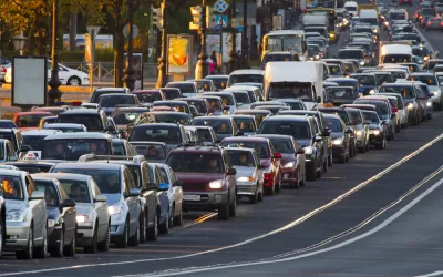
Lara Fishbane, Joseph Kane, and Adie Tomer of Brookings take a closer look at the level of service measure and the problems its use causes. LOS essentially measures congestion, but it also guides transportation planning as decision makers, planners, and other stakeholders work to improve LOS scores.
When LOS is used in efforts to address congestion, the solution too often is to build more roads, say Fishbane, Kane, and Tomer. The results are sprawl and transportation networks that decimate communities and privilege cars over other modes. "In short, the auto-centric development LOS makes possible has become one of the greatest obstacles to transportation choice and access, economic agglomeration, and environmental resilience."
They argue that different measures are needed — for example, multimodal measures and those that consider vehicle miles traveled instead of LOS. "Decreasing reliance on LOS also means introducing measures that don’t lead with transportation use, but instead with measures related to economic, social, and environmental outcomes," point out Fishbane, Kane, and Tomer.
In addition, they urge a shift away from a supply focus, which supports LOS, to one on travel demand. The result, they say, will be a better understanding of why people travel, how transportation systems can better serve users, and ways travel behavior can be changed.
FULL STORY: Stop trying to solve traffic and start building great places

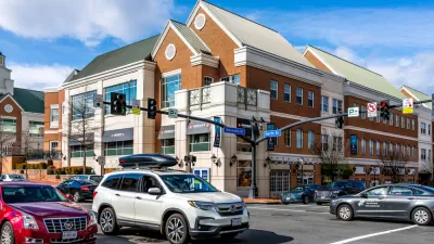
Shifting the Focus for Transportation Planning in Fairfax County
Fairfax County wants to move away from a heavy reliance on level of service in favor of more pedestrian- and transit-oriented planning.

Caltrans to Ditch Level of Service for Vehicle Miles Traveled
Unlike for land use regulations, state law doesn't require Caltrans to switch from Level of Service to Vehicle Miles Traveled in measuring the environmental impact of projects. The state department of transportation is making the change anyway.
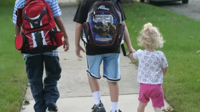
Kids Still Aren't Walking to School
Two generations ago, most children walked to school. But the numbers have dropped significantly.

Alabama: Trump Terminates Settlements for Black Communities Harmed By Raw Sewage
Trump deemed the landmark civil rights agreement “illegal DEI and environmental justice policy.”

Planetizen Federal Action Tracker
A weekly monitor of how Trump’s orders and actions are impacting planners and planning in America.

The 120 Year Old Tiny Home Villages That Sheltered San Francisco’s Earthquake Refugees
More than a century ago, San Francisco mobilized to house thousands of residents displaced by the 1906 earthquake. Could their strategy offer a model for the present?

Ken Jennings Launches Transit Web Series
The Jeopardy champ wants you to ride public transit.

BLM To Rescind Public Lands Rule
The change will downgrade conservation, once again putting federal land at risk for mining and other extractive uses.

Indy Neighborhood Group Builds Temporary Multi-Use Path
Community members, aided in part by funding from the city, repurposed a vehicle lane to create a protected bike and pedestrian path for the summer season.
Urban Design for Planners 1: Software Tools
This six-course series explores essential urban design concepts using open source software and equips planners with the tools they need to participate fully in the urban design process.
Planning for Universal Design
Learn the tools for implementing Universal Design in planning regulations.
Clanton & Associates, Inc.
Jessamine County Fiscal Court
Institute for Housing and Urban Development Studies (IHS)
City of Grandview
Harvard GSD Executive Education
Toledo-Lucas County Plan Commissions
Salt Lake City
NYU Wagner Graduate School of Public Service