


Maps of planned, never built, and defunct transit systems in cities from Cleveland to Atlanta and Phoenix back to Cincinnati are for sale.

Nick Swartsell shares the work of artist and transit enthusiast Jake Merman, who creates maps of "lost" subways and streetcar systems. These maps include systems that have been ripped out, and many that were planned and never built.
"He's drawn maps of Detroit's streetcar system circa 1950, a 1997 monorail proposal in Seattle, Cleveland's Electric Interurban Railway circa 1898 and a number of others," writes Swartsell.
Swartsell's specific interest in Merman's work stems from two maps of Cincinnati. "One shows Cincinnati's ill-fated subway system, color-coded by sections of the proposed 16-mile loop that still exist today, those that were built but later demolished and those that never left the drawing board, along with proposed connections to streetcars," explains Swartsell. "Berman's other Cincinnati-centric map features the 2002 Metro Moves initiative, a vast multi-modal transit system that would have been financed with a half-cent Hamilton County sales tax increase."
FULL STORY: Check Out These Cincinnati Transit Maps That Could Have Been

Minnesota, Vermont Experiment With Rural Trip Planning Websites
Pilot programs in the two states aimed to make transit information more accessible for riders in rural areas, where on-demand and microtransit services make trip planning more complex.

Excerpt: How Individualism Harms Public Transit
Jarrett Walker calls for a more social approach to transit planning.
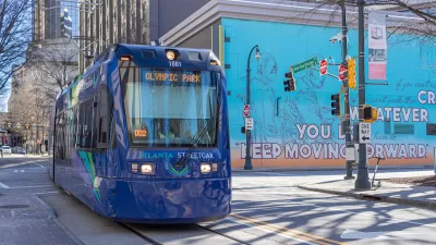
Atlanta Launches Regional Transit App
The app streamlines transit information from the region’s sometimes disjointed public transit system, which covers 13 counties.

Alabama: Trump Terminates Settlements for Black Communities Harmed By Raw Sewage
Trump deemed the landmark civil rights agreement “illegal DEI and environmental justice policy.”

Planetizen Federal Action Tracker
A weekly monitor of how Trump’s orders and actions are impacting planners and planning in America.

The 120 Year Old Tiny Home Villages That Sheltered San Francisco’s Earthquake Refugees
More than a century ago, San Francisco mobilized to house thousands of residents displaced by the 1906 earthquake. Could their strategy offer a model for the present?

Ken Jennings Launches Transit Web Series
The Jeopardy champ wants you to ride public transit.

BLM To Rescind Public Lands Rule
The change will downgrade conservation, once again putting federal land at risk for mining and other extractive uses.

Indy Neighborhood Group Builds Temporary Multi-Use Path
Community members, aided in part by funding from the city, repurposed a vehicle lane to create a protected bike and pedestrian path for the summer season.
Urban Design for Planners 1: Software Tools
This six-course series explores essential urban design concepts using open source software and equips planners with the tools they need to participate fully in the urban design process.
Planning for Universal Design
Learn the tools for implementing Universal Design in planning regulations.
Clanton & Associates, Inc.
Jessamine County Fiscal Court
Institute for Housing and Urban Development Studies (IHS)
City of Grandview
Harvard GSD Executive Education
Toledo-Lucas County Plan Commissions
Salt Lake City
NYU Wagner Graduate School of Public Service