


Cities will be allowed to lower speed limits to 10 miles per hour and prioritize pedestrians on certain streets.
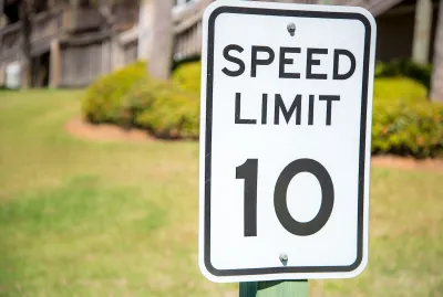
Washington Governor Bob Ferguson signed a bill that allows cities to create “shared streets” with speed limits of 10 miles per hour that allow pedestrians to use the middle of the street.
As Mark Ostrow explains in The Urbanist, Senate Bill 5595 eliminates jaywalking laws on shared streets, giving pedestrians true priority. For Ostrow, “Shared streets have the potential to dramatically change the way we move around cities in the state of Washington.”
The model, common in Europe and Asia, allows for multiple traffic modes while improving safety for all users. “Residents use shared streets as an extension of their homes, cafes spill into the street, and children move about freely.”
Ostrow offers examples from global cities, showing how even wide boulevards can become pedestrian-oriented corridors. Ostrow cites three key characteristics of successful shared streets: low speed limits, the legal right for pedestrians to use the entire street, and “a physical design compatible with the other two.” Washington’s SB 5595 offers the first two — but not the third, Ostrow notes. It will be up to cities to bring infrastructure up to a safe standard to make streets truly safe and walkable.
FULL STORY: Governor Signs Washington’s First-in-the-Nation Shared Streets Law

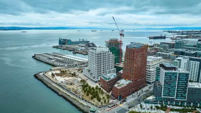
San Francisco Development Centers Pedestrians, Public Space
The Mission Rock project eliminates street parking, replacing it with public seating and landscaping.
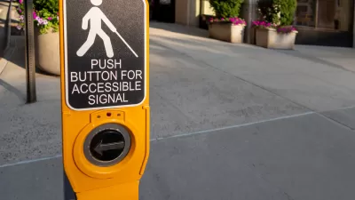
Accessibility and Car-Free Zones
Some critics of car-free zones call them exclusionary to people with disabilities, but other experts argue that, when properly planned, pedestrian enhancements improve safety and accessibility for everyone.
Accessibility and Car-Free Zones
Some critics of car-free zones call them exclusionary to people with disabilities, but other experts argue that, when properly planned, pedestrian enhancements improve safety and accessibility for everyone.

Rethinking Redlining
For decades we have blamed 100-year-old maps for the patterns of spatial racial inequity that persist in American cities today. An esteemed researcher says: we’ve got it all wrong.

Planetizen Federal Action Tracker
A weekly monitor of how Trump’s orders and actions are impacting planners and planning in America.

Montreal Mall to Become 6,000 Housing Units
Place Versailles will be transformed into a mixed-use complex over the next 25 years.

Santa Clara County Dedicates Over $28M to Affordable Housing
The county is funding over 600 new affordable housing units via revenue from a 2016 bond measure.

Why a Failed ‘Smart City’ Is Still Relevant
A Google-backed proposal to turn an underused section of Toronto waterfront into a tech hub holds relevant lessons about privacy and data.

When Sears Pioneered Modular Housing
Kit homes sold in catalogs like Sears and Montgomery Ward made homeownership affordable for midcentury Americans.
Urban Design for Planners 1: Software Tools
This six-course series explores essential urban design concepts using open source software and equips planners with the tools they need to participate fully in the urban design process.
Planning for Universal Design
Learn the tools for implementing Universal Design in planning regulations.
City of Camden Redevelopment Agency
City of Astoria
Transportation Research & Education Center (TREC) at Portland State University
Regional Transportation Commission of Southern Nevada
Toledo-Lucas County Plan Commissions