


Annapolis has launched an interactive Tree Canopy Map to engage residents in urban forestry efforts, highlighting tree coverage data and encouraging community involvement to achieve the city’s 50 percent canopy goal by 2050.
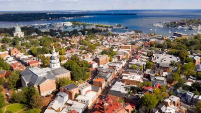
The City of Annapolis has introduced a new interactive Tree Canopy Map, aiming to engage residents in enhancing and sustaining the city's urban forest. This publicly accessible tool provides detailed information on individual street trees, including species, size, and environmental contributions such as carbon sequestration and stormwater reduction. By exploring the map, users can identify areas with sparse tree coverage and contribute to strategic planting efforts.
Developed in collaboration with PlanIT Geo, a leader in urban forestry software and consulting, the Tree Canopy Map allows residents to compare canopy coverage across different neighborhoods. This feature helps pinpoint regions that would benefit from additional tree planting, supporting the city's goal of achieving a 50 percent tree canopy by 2050. Currently, Annapolis stands at approximately 42 percent coverage, highlighting the need for community involvement to reach this target.
City officials emphasize the importance of public participation, noting that much of the available space for new trees is on residential properties. Urban Forester Brian Adams stated, "We need the public’s help to meet our tree canopy goals." Residents are encouraged to utilize the Tree Canopy Map to assess their neighborhoods and consider planting suitable trees, thereby contributing to a healthier and more resilient urban environment.
FULL STORY: Annapolis Launches Interactive Tree Canopy Map to Support Urban Forestry Efforts

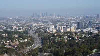
Updating LA’s Tree Rules Could Bring More Shade to Underserved Neighborhoods
A new USC study finds that relaxing Los Angeles’ outdated tree planting guidelines could significantly expand urban tree canopy and reduce shade disparities in lower-income neighborhoods, though infrastructure investments are also needed.
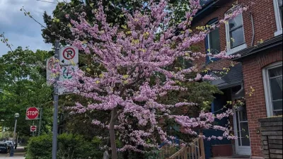
The Most Popular Tree on Google?
Meet Rodney: the Toronto tree getting rave reviews.

A Plan to Expand Tree Canopy Across Dayton
Dayton is developing an urban forest master plan, using a $2 million grant to expand its tree canopy, address decades of tree loss, and enhance environmental equity across the city.

Trump Administration Could Effectively End Housing Voucher Program
Federal officials are eyeing major cuts to the Section 8 program that helps millions of low-income households pay rent.

Planetizen Federal Action Tracker
A weekly monitor of how Trump’s orders and actions are impacting planners and planning in America.

The 120 Year Old Tiny Home Villages That Sheltered San Francisco’s Earthquake Refugees
More than a century ago, San Francisco mobilized to house thousands of residents displaced by the 1906 earthquake. Could their strategy offer a model for the present?

HSR Reaches Key Settlement in Northern California City
The state’s high-speed rail authority reached an agreement with Millbrae, a key city on the train’s proposed route to San Francisco.

Washington State Legislature Passes Parking Reform Bill
A bill that would limit parking requirements for new developments is headed to the governor’s desk.

Missouri Law Would Ban Protections for Housing Voucher Users
A state law seeks to overturn source-of-income discrimination bans passed by several Missouri cities.
Urban Design for Planners 1: Software Tools
This six-course series explores essential urban design concepts using open source software and equips planners with the tools they need to participate fully in the urban design process.
Planning for Universal Design
Learn the tools for implementing Universal Design in planning regulations.
Ada County Highway District
Clanton & Associates, Inc.
Jessamine County Fiscal Court
Institute for Housing and Urban Development Studies (IHS)
City of Grandview
Harvard GSD Executive Education
Toledo-Lucas County Plan Commissions
Salt Lake City
NYU Wagner Graduate School of Public Service