


Hoboken, New Jersey, is leveraging technology to up its curb management game with a digital streetscape map that will allow real-time demand monitoring.
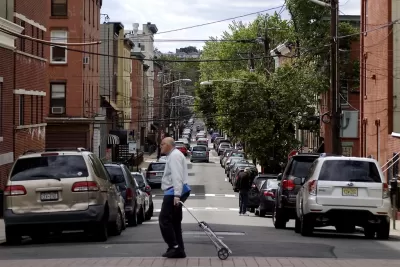
Transportation officials in Hoboken, New Jersey — a suburb of New York City — are digitizing their curbs into a real-time, digital city map. According to an article by Skip Descant in Government Technology, the effort is part of a project called The Curb Reimagined, a joint effort between the city, transportation tech platform Populus, and urban design firm Kimley-Horn.
The overall goal of the project is to transition the “streetscape from static, inflexible uses to more dynamic places capable of adjusting quickly,” Descant writes. “The end result should be a multidimensional map layered with details relevant to curbside problems like congestion and double parking, and to handling competitors for curb space like deliveries, ride-hailing and micromobility.”
Hoboken joins other cities like Seattle and Portland, Oregon, using digital tools to solve pain points and work to meet various city priorities, from parking to emissions goals.
“The project in Hoboken will enable the city to integrate and compare real-time parking data against curbside demand and revenue, a Populus leader said. The development of a database that includes curb and parking regulations will be part of a process known as “coding the city’s curbs,” creating information that can be digitally communicated with the city’s fleets,” Descant reports. The digital curb map will also be made public to keep residents and businesses informed.
FULL STORY: Curbs in Hoboken, N.J., Get Ready to Be ‘Reimagined’

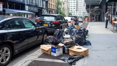
NYC Launches ‘Smart Curbs’ Program
The pilot program on the Upper West Side will remove some curbside parking spots to replace them with public seating, bike racks, and delivery zones.
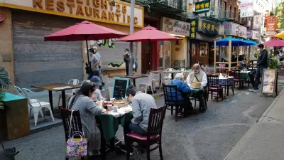
NYC Losing Many Outdoor Dining Areas Due to Expensive New Regulations
Restaurant owners say the city’s new outdoor dining program makes it too difficult and expensive to operate al fresco setups.
Reimagining the Curb: How Smart Curb Management is Transforming Urban Mobility
Modern demands for curbside space call for new ways to manage and allocate it.

Study: Maui’s Plan to Convert Vacation Rentals to Long-Term Housing Could Cause Nearly $1 Billion Economic Loss
The plan would reduce visitor accommodation by 25,% resulting in 1,900 jobs lost.

North Texas Transit Leaders Tout Benefits of TOD for Growing Region
At a summit focused on transit-oriented development, policymakers discussed how North Texas’ expanded light rail system can serve as a tool for economic growth.

Why Should We Subsidize Public Transportation?
Many public transit agencies face financial stress due to rising costs, declining fare revenue, and declining subsidies. Transit advocates must provide a strong business case for increasing public transit funding.

How to Make US Trains Faster
Changes to boarding platforms and a switch to electric trains could improve U.S. passenger rail service without the added cost of high-speed rail.

Columbia’s Revitalized ‘Loop’ Is a Hub for Local Entrepreneurs
A focus on small businesses is helping a commercial corridor in Columbia, Missouri thrive.

Invasive Insect Threatens Minnesota’s Ash Forests
The Emerald Ash Borer is a rapidly spreading invasive pest threatening Minnesota’s ash trees, and homeowners are encouraged to plant diverse replacement species, avoid moving ash firewood, and monitor for signs of infestation.
Urban Design for Planners 1: Software Tools
This six-course series explores essential urban design concepts using open source software and equips planners with the tools they need to participate fully in the urban design process.
Planning for Universal Design
Learn the tools for implementing Universal Design in planning regulations.
Ascent Environmental
Borough of Carlisle
Institute for Housing and Urban Development Studies (IHS)
City of Grandview
Harvard GSD Executive Education
Toledo-Lucas County Plan Commissions
Salt Lake City
NYU Wagner Graduate School of Public Service