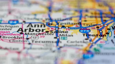
A pilot program will use GPS-enabled devices to track driving habits, allowing cities to use the data to create road pricing fee structures based on hyper-local and individual driving needs.

Utah announced a pilot program that could lead to “hyper-specific” road usage fees based on drivers’ specific driving habits and needs.
The program uses an electronic dongle to monitor exactly where, when, and how much people drive. “Then, communities can consolidate that data into a single road usage charge that can be automatically adjusted based on their unique priorities — think extra tolls for using the express lane, or graduated fees for low-income motorists who truly have to drive — and automatically distributed to the agencies that manage the exact roadways those drivers' actually traveled.”
The concept is one way to replace gas tax revenue that many states rely on heavily for transportation funding and that will rapidly shrink as electric vehicles become a larger share of the market. But it could face resistance from drivers with privacy concerns, Wilson notes. “Even if most U.S. drivers get past privacy concerns about equipping their vehicles with hyper-accurate GPS dongles and the dizzying network of high-tech eyes that are already watching them, they might fight back against being charged more for entering a busy downtown at rush hour, as New York City's long, messy congestion pricing fight has illustrated all too plainly.”
In the future, cities could use the technology to incentivize a reduction in driving or charge vehicles based on weight “to compensate for the extra damage they cause to roads (and the bodies of pedestrians they strike).”
FULL STORY: Utah’s ‘Road Usage Charging’ Pilot Could Finally Price the Roads Properly

Trump Administration Could Effectively End Housing Voucher Program
Federal officials are eyeing major cuts to the Section 8 program that helps millions of low-income households pay rent.

Planetizen Federal Action Tracker
A weekly monitor of how Trump’s orders and actions are impacting planners and planning in America.

Ken Jennings Launches Transit Web Series
The Jeopardy champ wants you to ride public transit.

Crime Continues to Drop on Philly, San Francisco Transit Systems
SEPTA and BART both saw significant declines in violent crime in the first quarter of 2025.

How South LA Green Spaces Power Community Health and Hope
Green spaces like South L.A. Wetlands Park are helping South Los Angeles residents promote healthy lifestyles, build community, and advocate for improvements that reflect local needs in historically underserved neighborhoods.

Sacramento Plans ‘Quick-Build’ Road Safety Projects
The city wants to accelerate small-scale safety improvements that use low-cost equipment to make an impact at dangerous intersections.
Urban Design for Planners 1: Software Tools
This six-course series explores essential urban design concepts using open source software and equips planners with the tools they need to participate fully in the urban design process.
Planning for Universal Design
Learn the tools for implementing Universal Design in planning regulations.
Heyer Gruel & Associates PA
Ada County Highway District
Institute for Housing and Urban Development Studies (IHS)
City of Grandview
Harvard GSD Executive Education
Toledo-Lucas County Plan Commissions
Salt Lake City
NYU Wagner Graduate School of Public Service


