


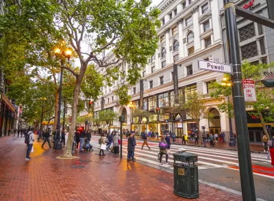
Multiple studies have quantified the early results from a project in San Francisco that blocked most private automobile traffic from Market Street in the city's downtown.
Regina Clelow shares news of a new study into the effects of Better Market Street in San Francisco, reporting large increases of the number of people riding scooters on the newly car-free Market Street:
The average daily scooter ridership the weeks of February 2–29, 2020 increased by 30 percent from the prior three weeks of January 5–25, 2020 before car-free Market.
Clelow puts the scooter ridership data in context of the vast, proven potential of micromobility and street changes to improve the safety and sustainability of city streets.
Another study, reported by Rachel Swan in February, found evidence of small increases in congestion on roads proximate to Market Street, proving incorrect predictions of gridlock (and not for the first time) as a result of removing cars from a major thoroughfare:
Congestion increased only marginally on nearby roads, according to new data from the traffic analytics firm Inrix. It shows that the biggest slowdown occurred on Mission Street, where southbound vehicle speeds decreased by 4% — from 10.3 miles per hour to 9.9 miles per hour — during the 8 a.m. commute. On other adjacent streets, car speeds declined by an average of 1%.
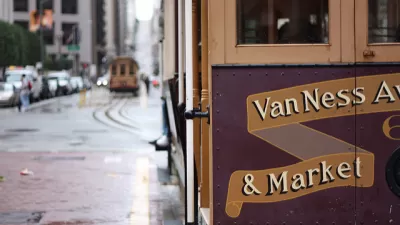
And for one final angle on the modes benefiting from Better Market Street, the Inrix report also found evidence of improved transit travel times along the corridor:
On the flip side, transit riders on Market Street benefited significantly from the removal of cars. Muni lines are running 6% faster on average, said Erica Kato, an agency spokeswoman. Some bus lines shaved 12% travel time, which means rides are two minutes shorter.
FULL STORY: San Francisco’s “Car-Free” Market Street Boosts Bike (and Scooter) Ridership

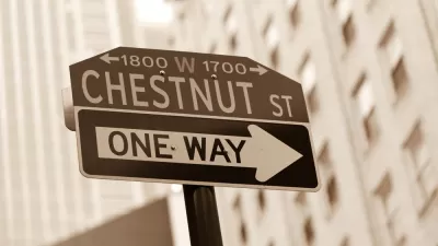
Philly Safe Streets Advocates Want What San Francisco and New York Are Having
The idea of blocking major streets to private automobiles is making advocates envious in cities that have yet to implement the idea. A petition is circulating to give the car-free treatment to Chestnut Street in Philadelphia.
Car-Free Market Street Approved in San Francisco
The San Francisco Municipal Transportation Agency Board of Directors approved the Better Market Street plan on October 15, 2019.
$604 Million Market Street Redesign Nears the Finish Line in San Francisco
Private automobiles could be prohibited on San Francisco's primary downtown thoroughfare, and already-wide sidewalks could be extended and smoothed over. The Better Market Street project is ready for its close up.

Trump Administration Could Effectively End Housing Voucher Program
Federal officials are eyeing major cuts to the Section 8 program that helps millions of low-income households pay rent.

Planetizen Federal Action Tracker
A weekly monitor of how Trump’s orders and actions are impacting planners and planning in America.

Ken Jennings Launches Transit Web Series
The Jeopardy champ wants you to ride public transit.

Rebuilding Smarter: How LA County Is Guiding Fire-Ravaged Communities Toward Resilience
Los Angeles County is leading a coordinated effort to help fire-impacted communities rebuild with resilience by providing recovery resources, promoting fire-wise design, and aligning reconstruction with broader sustainability and climate goals.

When Borders Blur: Regional Collaboration in Action
As regional challenges outgrow city boundaries, “When Borders Blur” explores how cross-jurisdictional collaboration can drive smarter, more resilient urban planning, sharing real-world lessons from thriving partnerships across North America.

Philadelphia Is Expanding its Network of Roundabouts
Roundabouts are widely shown to decrease traffic speed, reduce congestion, and improve efficiency.
Urban Design for Planners 1: Software Tools
This six-course series explores essential urban design concepts using open source software and equips planners with the tools they need to participate fully in the urban design process.
Planning for Universal Design
Learn the tools for implementing Universal Design in planning regulations.
Ada County Highway District
Clanton & Associates, Inc.
Jessamine County Fiscal Court
Institute for Housing and Urban Development Studies (IHS)
City of Grandview
Harvard GSD Executive Education
Toledo-Lucas County Plan Commissions
Salt Lake City
NYU Wagner Graduate School of Public Service