


Fire season is back, and it's not safe to breathe in huge swaths of the world.
The Ferguson Fire burning new Yosemite National Park has burned more than 40,000 acres and forced the evacuation of the park.
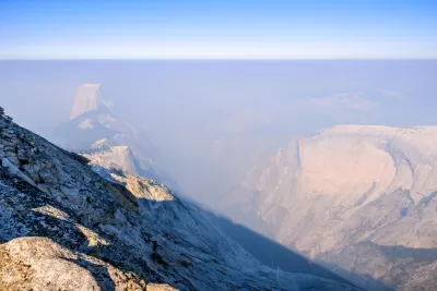
The Ferguson Fire inspired Patrick May to map smoke events around the world, including smoky conditions from wildfires in Colorado and Montana. Fort Smith, Arkansas makes the map for having the highest smoking rate in the entire nation. Around the globe, the tragic fires in Greece are on the map, as do air pollution meters in cities like Cairo, Egypt (as an example of pollution run amok) and Zabol, Iran (as an example of improvement).
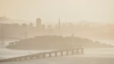
Despite broadening the map's scope to include other forms of smoke, it out some smoke events that should worry any one occupying the planet. Earlier this week, for instance, Southern Oregon, a region of natural splendor and home to public lands like Crater Lake National Park, reported the worst air quality in the country due to smoke from wildfires.
The Carr Fire in Shasta County in Northern California was sending ash the size of dimes falling onto the city of Redding, forcing evacuations of historic Old Shasta and neighborhoods in Redding.
FULL STORY: Don’t inhale: a map of smoke events around the world

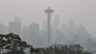
Wildfire Smoke Affecting Communities Across the Country
Wildfires in California and Colorado are spewing out smoke that is traveling to other parts of the country. The health effects of the dirty air are substantial, and they could last long after the fires are out.
Seattle Clean-Air Shelters to Provide Relief to Residents
Wildfires have caused the city’s air quality to plummet in recent years. The new shelters will give residents a break when the air is not fit to breathe.
Another Summer of Wildfires and Air Quality Emergencies
A third straight summer spent in a haze of smoke from nearby wildfires is taking a psychological toll on Seattle residents. A political response is also taking shape.

Alabama: Trump Terminates Settlements for Black Communities Harmed By Raw Sewage
Trump deemed the landmark civil rights agreement “illegal DEI and environmental justice policy.”

Planetizen Federal Action Tracker
A weekly monitor of how Trump’s orders and actions are impacting planners and planning in America.

The 120 Year Old Tiny Home Villages That Sheltered San Francisco’s Earthquake Refugees
More than a century ago, San Francisco mobilized to house thousands of residents displaced by the 1906 earthquake. Could their strategy offer a model for the present?

Ken Jennings Launches Transit Web Series
The Jeopardy champ wants you to ride public transit.

BLM To Rescind Public Lands Rule
The change will downgrade conservation, once again putting federal land at risk for mining and other extractive uses.

Indy Neighborhood Group Builds Temporary Multi-Use Path
Community members, aided in part by funding from the city, repurposed a vehicle lane to create a protected bike and pedestrian path for the summer season.
Urban Design for Planners 1: Software Tools
This six-course series explores essential urban design concepts using open source software and equips planners with the tools they need to participate fully in the urban design process.
Planning for Universal Design
Learn the tools for implementing Universal Design in planning regulations.
Clanton & Associates, Inc.
Jessamine County Fiscal Court
Institute for Housing and Urban Development Studies (IHS)
City of Grandview
Harvard GSD Executive Education
Toledo-Lucas County Plan Commissions
Salt Lake City
NYU Wagner Graduate School of Public Service