


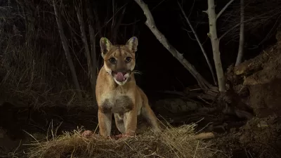
A coalition of researchers have identified one area near the 101 and other near I-15 that would help keep the big cats alive and healthy.
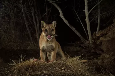
The plight of the Los Angeles mountain lion—living in a tangle of freeways—has, in recent years, been a topic of conversation often enough that a single crossing of the 101 makes the papers.
It’s also earned the attention of enough researchers that the National Park Service can now draw elaborate family trees—recently reproduced in the L.A. Times—that demonstrate how often they are hit by cars, and how the divided population has turned to inbreeding.
Fundraising was already underway, but a recent report from UC Davis, the National Park Service and the Nature Conservancy has identified two places for wildlife bridges that would accommodate the lions without drawing them too close to populated areas: one in Agoura Hills and another in Temecula. (It’s worth noting that mountain lions actively avoid humans whenever possible.)
The threat to biodiversity posed by urban sprawl has become a more frequent topic of conversation in the last decade, and there are now wildlife crossings around the world for everything from koalas to red crabs to salamanders.
FULL STORY: Mountain lions are being killed on freeways and weakened by inbreeding. Researchers have a solution

L.A. Wildlife Crossing To Break Ground This Spring
The planned wildlife bridge spanning an eight-lane freeway will be the world's largest and most ambitious project of its kind.
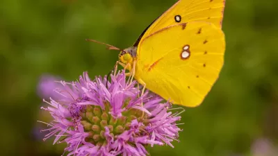
Study Reveals Los Angeles a Hotspot for Insect Diversity
A study reveals that L.A. is a surprising hotspot for insect and spider biodiversity, with diversity driven more by proximity to mountains and stable temperatures than by land value.

Cougar Death Highlights Urgent Need for Wildlife Crossing
A mountain lion was found dead on the 101 Freeway, less than half a mile from the steel and concrete endoskeleton of the Wallis Annenberg Wildlife Crossing.

Alabama: Trump Terminates Settlements for Black Communities Harmed By Raw Sewage
Trump deemed the landmark civil rights agreement “illegal DEI and environmental justice policy.”

Planetizen Federal Action Tracker
A weekly monitor of how Trump’s orders and actions are impacting planners and planning in America.

The 120 Year Old Tiny Home Villages That Sheltered San Francisco’s Earthquake Refugees
More than a century ago, San Francisco mobilized to house thousands of residents displaced by the 1906 earthquake. Could their strategy offer a model for the present?

Indy Neighborhood Group Builds Temporary Multi-Use Path
Community members, aided in part by funding from the city, repurposed a vehicle lane to create a protected bike and pedestrian path for the summer season.

Congestion Pricing Drops Holland Tunnel Delays by 65 Percent
New York City’s contentious tolling program has yielded improved traffic and roughly $100 million in revenue for the MTA.

In Both Crashes and Crime, Public Transportation is Far Safer than Driving
Contrary to popular assumptions, public transportation has far lower crash and crime rates than automobile travel. For safer communities, improve and encourage transit travel.
Urban Design for Planners 1: Software Tools
This six-course series explores essential urban design concepts using open source software and equips planners with the tools they need to participate fully in the urban design process.
Planning for Universal Design
Learn the tools for implementing Universal Design in planning regulations.
Clanton & Associates, Inc.
Jessamine County Fiscal Court
Institute for Housing and Urban Development Studies (IHS)
City of Grandview
Harvard GSD Executive Education
Toledo-Lucas County Plan Commissions
Salt Lake City
NYU Wagner Graduate School of Public Service