


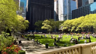
What do you think about the linked visual presentation of the history of urban planning?

.jpg)
Nick Routley shares a detailed infographic created by Konstantin von der Schulenburg, an architect with Cantrell and Crowley Architects and Interior Designer.
The infographic was first posted by von der Schulenburg at the Intercultural Urbanism blog in April 2016, sparking debate there about the design and wording choices made in the infographic.
Routley revives the infographic and presents additional history as background for the movements described in the infographic. Click through to see the graphics that support this narrative of the history of urban planning: The Nolli Map>Garden City>The Setback Principle>Broadacre City>Radiant City>Psychogeography>The Megaregion>The Transect.
FULL STORY: The Evolution of Urban Planning


Planning Year in Review 2023: Zoning Reform, a Rail Revolution, and Climate Realities
Last year’s most talked-about planning issues and news.

Planetizen’s Top Posts of 2023
The most-read articles on Planetizen in 2023.
All We Want for the Holidays is…
Here are a dozen timely gift ideas for creating better communities.

Alabama: Trump Terminates Settlements for Black Communities Harmed By Raw Sewage
Trump deemed the landmark civil rights agreement “illegal DEI and environmental justice policy.”

Planetizen Federal Action Tracker
A weekly monitor of how Trump’s orders and actions are impacting planners and planning in America.

The 120 Year Old Tiny Home Villages That Sheltered San Francisco’s Earthquake Refugees
More than a century ago, San Francisco mobilized to house thousands of residents displaced by the 1906 earthquake. Could their strategy offer a model for the present?

Ken Jennings Launches Transit Web Series
The Jeopardy champ wants you to ride public transit.

BLM To Rescind Public Lands Rule
The change will downgrade conservation, once again putting federal land at risk for mining and other extractive uses.

Indy Neighborhood Group Builds Temporary Multi-Use Path
Community members, aided in part by funding from the city, repurposed a vehicle lane to create a protected bike and pedestrian path for the summer season.
Urban Design for Planners 1: Software Tools
This six-course series explores essential urban design concepts using open source software and equips planners with the tools they need to participate fully in the urban design process.
Planning for Universal Design
Learn the tools for implementing Universal Design in planning regulations.
Clanton & Associates, Inc.
Jessamine County Fiscal Court
Institute for Housing and Urban Development Studies (IHS)
City of Grandview
Harvard GSD Executive Education
Toledo-Lucas County Plan Commissions
Salt Lake City
NYU Wagner Graduate School of Public Service