


Although there is a strong push for accessibility as a key metric in transportation and land use planning efforts, there is still a long way to go in putting theory and intentions into practice.
Accessibility is a popular buzzword among planning professionals. In fact, according to a 2017 analysis by the Brookings Institution, 22 of the 32 metropolitan transportation plans sampled for the report include accessibility in their vision, goals, or objectives.
According to Adie Tomer and Annibel Rice, "more people within the governance and planning communities have begun to subscribe to the concept of building around accessibility, or the ease of reaching destinations."
But, according to Tomer and Rice, "[th]e problem is that accessibility is still stuck in a theoretical place." After providing a list of the shortcomings of current accessibility metrics, Tomer and Rice provide a list of action items to move accessibility toward a more practical and deliverable presence in the planning process.
Here's the list of recommended action items, with a lot more detail provided in the source article:
- First, to promote tangible accessibility results, use clearly defined indicators to measure critical outcomes.
- Second, include accessibility criteria in the selection process for projects.
- Third, measure different destination types, transportation modes, and splits between target demographic groups.
- Fourth, use visualization tools and clear reporting of costs and benefits to inform the public.
FULL STORY: How Urban Planners Can Connect More People to Opportunity


Sioux Falls Multi-Family Development Outpaces Transportation Improvements
Sioux Falls, South Dakota is undergoing a multi-family development boom. Residents are increasingly concerned about the traffic the development brings, according to local news reports.
Planning for Congestion Relief
The third and final installment of Planetizen's examination of the role of the planning profession in both perpetuating and solving traffic congestion.
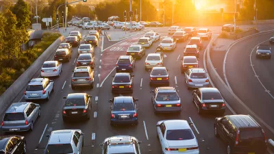
How Planning Fails to Solve Congestion
Solutions for congestion are never as simple and easy as armchair planners and engineers would like you to believe—especially those who suggest that congestion can be solved by forever building more roadway capacity.

Alabama: Trump Terminates Settlements for Black Communities Harmed By Raw Sewage
Trump deemed the landmark civil rights agreement “illegal DEI and environmental justice policy.”

Planetizen Federal Action Tracker
A weekly monitor of how Trump’s orders and actions are impacting planners and planning in America.

The 120 Year Old Tiny Home Villages That Sheltered San Francisco’s Earthquake Refugees
More than a century ago, San Francisco mobilized to house thousands of residents displaced by the 1906 earthquake. Could their strategy offer a model for the present?

Ken Jennings Launches Transit Web Series
The Jeopardy champ wants you to ride public transit.

BLM To Rescind Public Lands Rule
The change will downgrade conservation, once again putting federal land at risk for mining and other extractive uses.

Indy Neighborhood Group Builds Temporary Multi-Use Path
Community members, aided in part by funding from the city, repurposed a vehicle lane to create a protected bike and pedestrian path for the summer season.
Urban Design for Planners 1: Software Tools
This six-course series explores essential urban design concepts using open source software and equips planners with the tools they need to participate fully in the urban design process.
Planning for Universal Design
Learn the tools for implementing Universal Design in planning regulations.
Clanton & Associates, Inc.
Jessamine County Fiscal Court
Institute for Housing and Urban Development Studies (IHS)
City of Grandview
Harvard GSD Executive Education
Toledo-Lucas County Plan Commissions
Salt Lake City
NYU Wagner Graduate School of Public Service