


Six thousand different maps of Chicago can now be automatically dissected online.

Chicago Cityscape has announced a new online tool that breaks down the zoning on a map of any part of a Chicago. Steven Vance writes:
Zoning Assessment is a new, automated tool that measures the kind of different zoning districts in any of the more than 6,000 maps of Chicago on Chicago Cityscape. With it you can see how much residential-only, mixed-use, or planned developments make up a ward, community, or the area around a CTA station.
While Vance warns that zoning may not indicate actual land use, he also highlights the utility of even limited zoning analysis. For example, he uses the tool to identify low-density residential areas with 24-hour rapid transit service, opening up questions about the level of transit-oriented development there. More details, examples, and images of the tool are available at Chicago Cityscape.
FULL STORY: New tool automatically analyzes the zoning map in any part of Chicago


Uber Releases Open-Source Mapping Tool
Individuals and major companies alike have already found a variety of applications for the software.
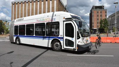
Report: Zoning Reforms Should Complement Nashville’s Ambitious Transit Plan
Without reform, restrictive zoning codes will limit the impact of the city’s planned transit expansion and could exclude some of the residents who depend on transit the most.

Texas Churches Rally Behind ‘Yes in God’s Back Yard’ Legislation
Religious leaders want the state to reduce zoning regulations to streamline leasing church-owned land to housing developers.

Alabama: Trump Terminates Settlements for Black Communities Harmed By Raw Sewage
Trump deemed the landmark civil rights agreement “illegal DEI and environmental justice policy.”

Planetizen Federal Action Tracker
A weekly monitor of how Trump’s orders and actions are impacting planners and planning in America.

The 120 Year Old Tiny Home Villages That Sheltered San Francisco’s Earthquake Refugees
More than a century ago, San Francisco mobilized to house thousands of residents displaced by the 1906 earthquake. Could their strategy offer a model for the present?

In Both Crashes and Crime, Public Transportation is Far Safer than Driving
Contrary to popular assumptions, public transportation has far lower crash and crime rates than automobile travel. For safer communities, improve and encourage transit travel.

Report: Zoning Reforms Should Complement Nashville’s Ambitious Transit Plan
Without reform, restrictive zoning codes will limit the impact of the city’s planned transit expansion and could exclude some of the residents who depend on transit the most.

Judge Orders Release of Frozen IRA, IIJA Funding
The decision is a victory for environmental groups who charged that freezing funds for critical infrastructure and disaster response programs caused “real and irreparable harm” to communities.
Urban Design for Planners 1: Software Tools
This six-course series explores essential urban design concepts using open source software and equips planners with the tools they need to participate fully in the urban design process.
Planning for Universal Design
Learn the tools for implementing Universal Design in planning regulations.
Clanton & Associates, Inc.
Jessamine County Fiscal Court
Institute for Housing and Urban Development Studies (IHS)
City of Grandview
Harvard GSD Executive Education
Toledo-Lucas County Plan Commissions
Salt Lake City
NYU Wagner Graduate School of Public Service