


Researchers at the University of Nebraska have been working with the Nebraska Department of Natural Resources to develop best practices for predicting and planning for the future water needs of urban developments.
It’s often taken for granted, because it seems so simple – turn on a faucet and there’s water. But managing a finite resource in a landlocked state is anything but simple.
In fact, five state agencies and 23 locally elected Natural Resource Districts all play a role in safeguarding Nebraska’s water. The University of Nebraska-Lincoln, through many research partnerships with state agencies, is a part of the effort, too.
Researchers in the College of Architecture and the School of Natural Resources have been working with the Nebraska Department of Natural Resources to develop best practices for predicting and planning for the future water needs of urban developments. In a forthcoming study led by Zhenghong Tang, associate professor in the Community and Regional Planning Program at Nebraska, Husker scholars have provided a novel approach for state water resource managers or city planners to estimate future consumptive water use – water that is not recycled – in residential areas in cities and small towns.
Their new approach pairs water use data with high-resolution aerial images gathered from geographical information systems to estimate urban consumptive water use for the populated areas. The images reveal landscape features that directly impact water loss.
“In the current research, there is no fast way to estimate residential consumptive water use,” Tang said. “Our model developed a simplified way to estimate it quickly and cost-efficiently.”
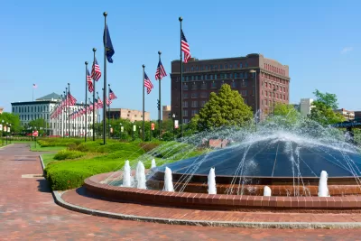
The model’s emphasis on residential areas also is new to Nebraska. Historically, the state’s water management efforts have focused primarily on agriculture and crop irrigation, since agricultural production is the state’s chief economic driver. During the last decade, however, the state has begun new efforts for residential water planning in response to the population’s shift to more urbanized areas.
“We were tasked with providing better models for the management of water resources in municipalities and residential areas and to provide more information for the state and its stakeholders,” Tang said. “Agriculture is the largest consumer of the state’s water resources, but now, two-thirds of the population lives in urban areas and industry is taking a larger share of resources. Not planning for this could be harmful to the state’s economy, and its citizens.”
Tang said analysis of Sidney, Grand Island and Lincoln showed how per capita water usage increases as a result of suburban growth. As the cities dispersed from urban centers into suburban developments, water usage rose even though their populations were less dense. The spatial analysis showed higher water usage in suburban areas with larger landscape areas and lower water usage in downtown areas.
Tang said future city planners could use this information and the water use estimation model to design more water efficient and drought-resilient developments.
“It is critical to plan for population and industry growth in urban areas when developing integrated water management plans, and to account for drought,” Tang said.
The study will be published in the November issue of the journal Sustainable Cities and Society and is available here.
by Deann Gayman | University Communication
FULL STORY: Husker research flows to help state's water management plan

Water Diversion Controversy Stifles Milwaukee Suburb's Growth Plans
The city of Waukesha asked for more water than the Great Lakes Compact would allow. Commenters remind the city of Waukesha that water for growth was never the goal of the Great Lakes Compact.

El Paso Wastewater Purification Facility Breaks Ground
As water supplies become strained and technology advances, cities look to wastewater as a viable source of drinking water.

Virginia Data Centers Draining State’s Water Supply
Being the world’s largest data center hub is having a severe impact on local water resources.

What ‘The Brutalist’ Teaches Us About Modern Cities
How architecture and urban landscapes reflect the trauma and dysfunction of the post-war experience.

‘Complete Streets’ Webpage Deleted in Federal Purge
Basic resources and information on building bike lanes and sidewalks, formerly housed on the government’s Complete Streets website, are now gone.

The VW Bus is Back — Now as an Electric Minivan
Volkswagen’s ID. Buzz reimagines its iconic Bus as a fully electric minivan, blending retro design with modern technology, a 231-mile range, and practical versatility to offer a stylish yet functional EV for the future.

Healing Through Parks: Altadena’s Path to Recovery After the Eaton Fire
In the wake of the Eaton Fire, Altadena is uniting to restore Loma Alta Park, creating a renewed space for recreation, community gathering, and resilience.

San Diego to Rescind Multi-Unit ADU Rule
The city wants to close a loophole that allowed developers to build apartment buildings on single-family lots as ADUs.

Electric Vehicles for All? Study Finds Disparities in Access and Incentives
A new UCLA study finds that while California has made progress in electric vehicle adoption, disadvantaged communities remain underserved in EV incentives, ownership, and charging access, requiring targeted policy changes to advance equity.
Urban Design for Planners 1: Software Tools
This six-course series explores essential urban design concepts using open source software and equips planners with the tools they need to participate fully in the urban design process.
Planning for Universal Design
Learn the tools for implementing Universal Design in planning regulations.
City of Albany
UCLA Lewis Center for Regional Policy Studies
Mpact (formerly Rail~Volution)
Chaddick Institute at DePaul University
City of Piedmont, CA
Great Falls Development Authority, Inc.
HUDs Office of Policy Development and Research