


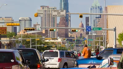
Austin has mostly been planning, designing, and engineering its streets the same way for 20 years. A new Street Design Guide would pave the way for a new era.

Syeda Hasan reports on the new draft of the Austin Street Design Guide [pdf], released earlier this week.
"The guide takes into account some key considerations to try and make Austin streets more uniform and consistent, including the community surrounding a street, the number of lanes and different modes of transportation options, like bikes and public transit," writes Hasan.
"The new guide divides each street into three sections – pedestrian zones, bicycle zones and motor vehicle and transit zones; it recommends dimensions for each of those features. It also categorizes streets by their context, like urban, suburban or industrial," adds Hasan.
The article includes soundbites provided by Annick Beaudet, a manager with the Austin Transportation Department, and Liane Miller, a project manager with the Austin Transportation Department. Both provide insight into how the guide will update the city's existing transportation plan.
Though the city's transportation plan hasn't been updated in 20 years, the city did earn acclaim for its 2014 complete streets policy.
FULL STORY: Austin Unveils New Guide For The Future Of Street Design

Austin Strategic Mobility Plan Final Draft Released
The first priority of the draft Austin Strategic Mobility Plan is to reduce single-occupant vehicle trips.

Catch Up With Austin's CodeNEXT
CodeNEXT is one of the most ambitious, and controversial, zoning reform projects ongoing in the country, with lessons to offer planners all over the country in code writing, public outreach, and planning outcomes.

US Street Design Manual Inches Toward Safer Roads
The guiding document for U.S. road design is starting to recognize the needs of people walking and biking, but safe streets advocates say more significant changes are needed to reduce the high number of pedestrian deaths and improve connectivity for all road users.

Alabama: Trump Terminates Settlements for Black Communities Harmed By Raw Sewage
Trump deemed the landmark civil rights agreement “illegal DEI and environmental justice policy.”

Planetizen Federal Action Tracker
A weekly monitor of how Trump’s orders and actions are impacting planners and planning in America.

The 120 Year Old Tiny Home Villages That Sheltered San Francisco’s Earthquake Refugees
More than a century ago, San Francisco mobilized to house thousands of residents displaced by the 1906 earthquake. Could their strategy offer a model for the present?

Ken Jennings Launches Transit Web Series
The Jeopardy champ wants you to ride public transit.

BLM To Rescind Public Lands Rule
The change will downgrade conservation, once again putting federal land at risk for mining and other extractive uses.

Indy Neighborhood Group Builds Temporary Multi-Use Path
Community members, aided in part by funding from the city, repurposed a vehicle lane to create a protected bike and pedestrian path for the summer season.
Urban Design for Planners 1: Software Tools
This six-course series explores essential urban design concepts using open source software and equips planners with the tools they need to participate fully in the urban design process.
Planning for Universal Design
Learn the tools for implementing Universal Design in planning regulations.
Clanton & Associates, Inc.
Jessamine County Fiscal Court
Institute for Housing and Urban Development Studies (IHS)
City of Grandview
Harvard GSD Executive Education
Toledo-Lucas County Plan Commissions
Salt Lake City
NYU Wagner Graduate School of Public Service