


Zoning around Chicago's public transit in relatively affluent areas won't allow for density or any kind of housing other than single family homes.
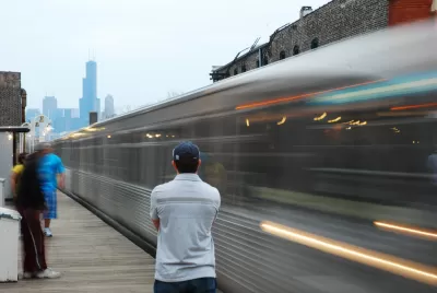
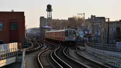
Chicago's Brown and Blue lines pass through a variety of neighborhoods, many of which are gentrifying and very attractive to young Chicagoans. So how much of the housing is zoned for apartments? Less than half. "City zoning code allows only single-family houses on 50.6 percent of the land within two blocks of Brown Line stations between Kimball and Southport," writes Steven Vance for Chicago Cityscape.
The strict zoning around these transit stops is not consistent with zoning around other stops on the city's North Side. "Areas in the North Side around the Blue and Brown Lines don’t have the same medium and high-density zoning districts as the areas around the Red Line. This situation leads to lower housing production of the 'missing middle' — housing that has more units than a single-family house, but wouldn’t be classified as a high-rise," Vance writes. This zoning is counterproductive for a city that is struggling to maintain its population.
FULL STORY: Too much land around CTA stations doesn’t allow more than single-family housing

Demolition Starts for CTA's Controversial Flyover Project
The Chicago Transit Authority's Red-Purple Bypass Project will add an additional track to speed up trains passing through the Belmont Station. The project requires the demolition of several neighborhood buildings.
Major Ride Share Companies Accused of Taking Advantage of CTA Fatality
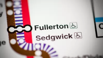
An apparent suicide stopped trains Tuesday morning at the Fullerton stop, which serves as a hub for Chicago's North Side transit. Prices for a ride from the area to downtown via Lyft reached triple digits.
New Guide Helps Citizens and Communities Understand Zoning
"Chicago Land Use: A Guide for Communities" is a new online resource whose release has been accompanied by community events to share info and empower Chicagoans to understand the zoning where they live.

Alabama: Trump Terminates Settlements for Black Communities Harmed By Raw Sewage
Trump deemed the landmark civil rights agreement “illegal DEI and environmental justice policy.”

Planetizen Federal Action Tracker
A weekly monitor of how Trump’s orders and actions are impacting planners and planning in America.

The 120 Year Old Tiny Home Villages That Sheltered San Francisco’s Earthquake Refugees
More than a century ago, San Francisco mobilized to house thousands of residents displaced by the 1906 earthquake. Could their strategy offer a model for the present?

Ken Jennings Launches Transit Web Series
The Jeopardy champ wants you to ride public transit.

BLM To Rescind Public Lands Rule
The change will downgrade conservation, once again putting federal land at risk for mining and other extractive uses.

Indy Neighborhood Group Builds Temporary Multi-Use Path
Community members, aided in part by funding from the city, repurposed a vehicle lane to create a protected bike and pedestrian path for the summer season.
Urban Design for Planners 1: Software Tools
This six-course series explores essential urban design concepts using open source software and equips planners with the tools they need to participate fully in the urban design process.
Planning for Universal Design
Learn the tools for implementing Universal Design in planning regulations.
Clanton & Associates, Inc.
Jessamine County Fiscal Court
Institute for Housing and Urban Development Studies (IHS)
City of Grandview
Harvard GSD Executive Education
Toledo-Lucas County Plan Commissions
Salt Lake City
NYU Wagner Graduate School of Public Service