


The NYC Transit Explorer from Sidewalk Labs shows how much transit service New Yorkers stand to lose when the L Train shuts down for 18 months.
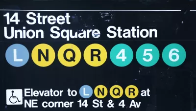
Dan Vanderkam writes a post to explain how Sidewalk Labs worked with the New York-based advocacy group Transportation Alternatives to create an interactive tool to illustrate how the looming shutdown of the L Train in New York will affect residents and commuters.
The tool is a map demo we’re calling the NYC Transit Explorer. It’s built on top of a transit router that uses the latest GTFS feeds for all MTA bus and subway lines, as well as the Staten Island ferry, to determine travel times and routes throughout the five boroughs. Traditional navigation routers direct people from Point A to Point B (call it one-to-one); our router adds the ability to show people how long it would take to get anywhere in the city via transit from a given origin (one-to-many).
After explaining the tool, Vanderkam then walks through step-by-step examples to show how the L Train closure will affect transit trips between Brooklyn and Manhattan—in terms of general accessibility and along specific routes. The post concludes with a call to action developers and civic hackers for help improving the tool.
FULL STORY: New map demo: How the L train shutdown will impact your commute

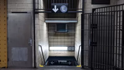
First Weekend of L Train Slowdown Could Have Been Worse
The long awaited repair work on the L Train between Brooklyn and Manhattan launched over the weekend.
Breaking: Gov. Cuomo Cancels L Train Closure
Surprise, shocking news from New York City, as Governor Andrew Cuomo steps in at the 11th hour to change course on the highly anticipated (and dreaded) L Train closure scheduled to begin later this year.
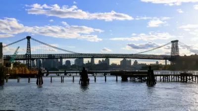
Single-Occupant Vehicles Banned on Williamsburg Bridge During L Train Closure
Solo commuters crossing from Brooklyn to Manhattan on the Williamsburg Bridge are in for a rude awakening on April 27 when the L Train closes. To accommodate more buses and bikes on the 115-year old bridge, cars will need at least 3 people.

Alabama: Trump Terminates Settlements for Black Communities Harmed By Raw Sewage
Trump deemed the landmark civil rights agreement “illegal DEI and environmental justice policy.”

Planetizen Federal Action Tracker
A weekly monitor of how Trump’s orders and actions are impacting planners and planning in America.

The 120 Year Old Tiny Home Villages That Sheltered San Francisco’s Earthquake Refugees
More than a century ago, San Francisco mobilized to house thousands of residents displaced by the 1906 earthquake. Could their strategy offer a model for the present?

Ken Jennings Launches Transit Web Series
The Jeopardy champ wants you to ride public transit.

BLM To Rescind Public Lands Rule
The change will downgrade conservation, once again putting federal land at risk for mining and other extractive uses.

Indy Neighborhood Group Builds Temporary Multi-Use Path
Community members, aided in part by funding from the city, repurposed a vehicle lane to create a protected bike and pedestrian path for the summer season.
Urban Design for Planners 1: Software Tools
This six-course series explores essential urban design concepts using open source software and equips planners with the tools they need to participate fully in the urban design process.
Planning for Universal Design
Learn the tools for implementing Universal Design in planning regulations.
Clanton & Associates, Inc.
Jessamine County Fiscal Court
Institute for Housing and Urban Development Studies (IHS)
City of Grandview
Harvard GSD Executive Education
Toledo-Lucas County Plan Commissions
Salt Lake City
NYU Wagner Graduate School of Public Service