


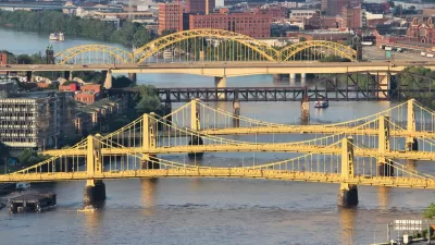
A new, interactive feature by The Washington Post endeavors to bring the point about the nation's crumbling infrastructure closer to home.

The Washington Post has published a large, interactive feature on the state of the nation's bridges, mapping the locations of the "structurally deficient" and "functionally obsolete" bridges around the United States. The interactive map zooms to the county level, automatically if you allow the site access to your location.
At this writing, for instance, I'm in Contra Costa County, California, where the interactive feature reports that there are 46 structurally deficient bridges, 89 functionally obsolete bridges, and 458 bridges in good condition. Along side the custom report on the county, the feature offers a geo-tagged satellite view of all the deficient and obsolete bridges around the region.
Denise Lu and Dan Keting supplement the interactive features with an article introducing the key terms and data that drive the interactive map. The article concludes by focusing on a sample of counties with high rates of structurally deficient bridges, namely Suffolk County, Massachusetts; Schuylkill County, Pennsylvania; and Nemaha County, Nebraska.
FULL STORY: How many structurally deficient bridges are in your county?


Two Bridges Across the Ohio River in Cincinnati Closed on the Same Day
Two of the transportation connections between Ohio and Kentucky in the Cincinnati metropolitan area were closed on the same day, leaving one side of the Ohio River cut off from the other.

Crack in Bridge Connecting Arkansas to Tennessee Comes With Consequences, Debate
Goods movement on the Mississippi River, as well as truck traffic on a key interstate, has ground to a halt after a crack was discovered last week in a bridge on Interstate 40 connecting to Memphis.
Roads and Bridges Are Not Crumbling
Rebutting the argument that roads and bridges are "crumbling" and should be our first infrastructure priority.

Alabama: Trump Terminates Settlements for Black Communities Harmed By Raw Sewage
Trump deemed the landmark civil rights agreement “illegal DEI and environmental justice policy.”

Planetizen Federal Action Tracker
A weekly monitor of how Trump’s orders and actions are impacting planners and planning in America.

The 120 Year Old Tiny Home Villages That Sheltered San Francisco’s Earthquake Refugees
More than a century ago, San Francisco mobilized to house thousands of residents displaced by the 1906 earthquake. Could their strategy offer a model for the present?

Indy Neighborhood Group Builds Temporary Multi-Use Path
Community members, aided in part by funding from the city, repurposed a vehicle lane to create a protected bike and pedestrian path for the summer season.

Congestion Pricing Drops Holland Tunnel Delays by 65 Percent
New York City’s contentious tolling program has yielded improved traffic and roughly $100 million in revenue for the MTA.

In Both Crashes and Crime, Public Transportation is Far Safer than Driving
Contrary to popular assumptions, public transportation has far lower crash and crime rates than automobile travel. For safer communities, improve and encourage transit travel.
Urban Design for Planners 1: Software Tools
This six-course series explores essential urban design concepts using open source software and equips planners with the tools they need to participate fully in the urban design process.
Planning for Universal Design
Learn the tools for implementing Universal Design in planning regulations.
Clanton & Associates, Inc.
Jessamine County Fiscal Court
Institute for Housing and Urban Development Studies (IHS)
City of Grandview
Harvard GSD Executive Education
Toledo-Lucas County Plan Commissions
Salt Lake City
NYU Wagner Graduate School of Public Service