


"Smell-mapping" is gaining attention from urban planners, data scientists, and nature conservationists alike.

Next week, artist Kate McLean will lead "smellwalks" through London, inviting participants to guess at mysterious scents and sniff strangers (with their consent.)
McLean is an artist, but her work is part of a data science project that could have implications for real estate and virtual reality tech. At GoodCityLife.org, researchers track keywords on social media to create digital "smellscapes"—color-coded maps marked red for emissions, green for nature, and so on.
Citymetric explores the possible applications of this work—like enhancing tours of national parks, or improving virtual reality technology by introducing "a full sphere of perceptions of a space."
And, if home values reflect "the positivity of the environment," smell-mapping could even affect real estate. One researcher hopes to work with cities on "interventions" in places with low-scoring smells, especially if those odors correspond to potential health risks. In part for that reason, the project measures a place's smell against people's perceptions of it, ranking places' "Likeability". For instance:
The Bayshore Freeway in San Francisco, for example, predominantly smells of emissions, according to the data … The emotion most commonly affiliated with the freeway is "sadness."
FULL STORY: How city "smell-mappers" can help virtual reality, real estate and how we understand the past

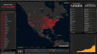
How Mapping Tools Played a Role in Understanding COVID-19
A new episode of the Geospatial Revolution Project assesses how scientists used digital mapping tools to think about the pandemic.
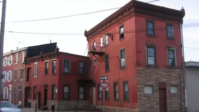
Real-Estate Site Locates Redevelopment Potential Across Philadelphia
A new map-based web tool created by a former city employee calculates the redevelopment potential of every parcel in Philadelphia.
Virtual Reality a Game Changer for Real Estate
The New York Times details how virtual reality is expected to change the game of real estate. The possibilities for planners and architects are endless as well.

Alabama: Trump Terminates Settlements for Black Communities Harmed By Raw Sewage
Trump deemed the landmark civil rights agreement “illegal DEI and environmental justice policy.”

Planetizen Federal Action Tracker
A weekly monitor of how Trump’s orders and actions are impacting planners and planning in America.

The 120 Year Old Tiny Home Villages That Sheltered San Francisco’s Earthquake Refugees
More than a century ago, San Francisco mobilized to house thousands of residents displaced by the 1906 earthquake. Could their strategy offer a model for the present?

In Both Crashes and Crime, Public Transportation is Far Safer than Driving
Contrary to popular assumptions, public transportation has far lower crash and crime rates than automobile travel. For safer communities, improve and encourage transit travel.

Report: Zoning Reforms Should Complement Nashville’s Ambitious Transit Plan
Without reform, restrictive zoning codes will limit the impact of the city’s planned transit expansion and could exclude some of the residents who depend on transit the most.

Judge Orders Release of Frozen IRA, IIJA Funding
The decision is a victory for environmental groups who charged that freezing funds for critical infrastructure and disaster response programs caused “real and irreparable harm” to communities.
Urban Design for Planners 1: Software Tools
This six-course series explores essential urban design concepts using open source software and equips planners with the tools they need to participate fully in the urban design process.
Planning for Universal Design
Learn the tools for implementing Universal Design in planning regulations.
Clanton & Associates, Inc.
Jessamine County Fiscal Court
Institute for Housing and Urban Development Studies (IHS)
City of Grandview
Harvard GSD Executive Education
Toledo-Lucas County Plan Commissions
Salt Lake City
NYU Wagner Graduate School of Public Service