


Daniel Kay Hertz argues that, besides improving service, a little signage could save the city of Chicago billions of dollars in service expansion costs.
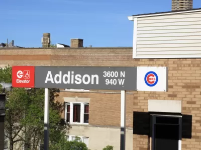
The city of Chicago recently received over a billion dollars in federal funding to expand service to its North Side Red, Brown and Purple Lines, Daniel Kay Hertz argues that "Making all of Chicago’s rail lines clear and viable options for public transit would be equivalent to spending tens of billions of dollars to expand the L," in an article for Chicago Magazine. Simply making signs that direct commuters on the way to get from one train to another could make a huge difference in how people travel through the city. Most commuters in Chicago are only familiar with the transit system, in part because a CTA map only shows the eight trains the CTA controls. "There are actually 20 rail lines that serve Chicago: eight CTA lines, 11 Metra lines, and the South Shore Line, a commuter railroad that runs into northwest Indiana," Daniel Kay Hertz writes in Chicago Magazine.
Chicago Transit organizations exist under the umbrella organization of the RTA which has begun to work toward this goal. "The RTA has created maps that show travelers all of their transit options, regardless of the agency that provides them, and is placing them at 14 more locations around Chicagoland, after beginning with just four in the last few years," Hertz writes. There's no reason that coordination needs to stop at signs, Hertz suggests that Chicago could follow Toronto's example and make their regional trains (a Metra equivalent) run more frequently so that riders could more easily transfer from the CTA.
FULL STORY: These New Transit Signs Could Save Chicago Billions of Dollars

Chicago Transit Increasing Rail Service to Pre-Pandemic Levels
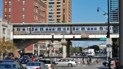
The Chicago Transit Authority is close to returning both rail and bus service to pre-pandemic schedules, with some adjustments for new travel demand.

Chicago Transit Report Calls for Income-Based Fares, Paratransit Funding
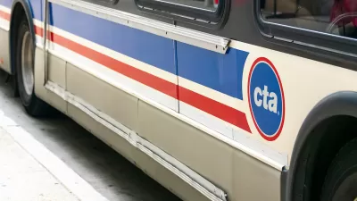
An RTA report highlights a need for state funding to bridge an imminent $730 budget shortfall, calling for an approach that relies less heavily on fare revenue.
Chicago Transit Releases 2024 Budget
The agency projects modest ridership growth while aiming to make long-term investments in bus and rail improvements.

Alabama: Trump Terminates Settlements for Black Communities Harmed By Raw Sewage
Trump deemed the landmark civil rights agreement “illegal DEI and environmental justice policy.”

Planetizen Federal Action Tracker
A weekly monitor of how Trump’s orders and actions are impacting planners and planning in America.

The 120 Year Old Tiny Home Villages That Sheltered San Francisco’s Earthquake Refugees
More than a century ago, San Francisco mobilized to house thousands of residents displaced by the 1906 earthquake. Could their strategy offer a model for the present?

Ken Jennings Launches Transit Web Series
The Jeopardy champ wants you to ride public transit.

BLM To Rescind Public Lands Rule
The change will downgrade conservation, once again putting federal land at risk for mining and other extractive uses.

Indy Neighborhood Group Builds Temporary Multi-Use Path
Community members, aided in part by funding from the city, repurposed a vehicle lane to create a protected bike and pedestrian path for the summer season.
Urban Design for Planners 1: Software Tools
This six-course series explores essential urban design concepts using open source software and equips planners with the tools they need to participate fully in the urban design process.
Planning for Universal Design
Learn the tools for implementing Universal Design in planning regulations.
Clanton & Associates, Inc.
Jessamine County Fiscal Court
Institute for Housing and Urban Development Studies (IHS)
City of Grandview
Harvard GSD Executive Education
Toledo-Lucas County Plan Commissions
Salt Lake City
NYU Wagner Graduate School of Public Service