


A new mapping tool shows the potential devastation along the Rhode Island coast caused by rising waters from climate change and storm surges.
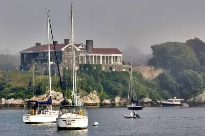
Researchers at the University of Rhode Island and the Rhode Island Coastal Resources Management Council have developed a new mapping tool that models potential flooding damage from rising seas and the storm surge from potentially deadly hurricanes. Alex Kuffner of the Providence Journal writes that the new mapping tool known as CERI (short for Coastal Environmental Risk Index)combines Google Earth data along with a pre-existing mapping software knows as StormTools to give users a predictive model of what would happen in different scenarios, including a strike by a 100 year storm. The tool further combines data about existing housing along the coast with estimates of damage from the Army Corps of Engineers.
The maps incorporate information on housing structures from Rhode Island’s E-911 emergency response database, which not only pinpoints houses using satellite information but also divides them into general categories: with basement or without, elevated or not, one story or two, and so on.
The results of the simulations from CERI are impacting how towns along the coast plan ahead for potentially damaging flooding. The director of planning for Warwick, RI says that the data could influence how emergency response is managed and the requirement for height of future homes above grade.
FULL STORY: Rising seas, rising stakes: R.I. researchers project future flooding

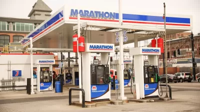
Providence Could Ban New Gas Stations
The city could prohibit the construction of new fueling stations within city limits to discourage driving and pave the way for more renewable transportation infrastructure.
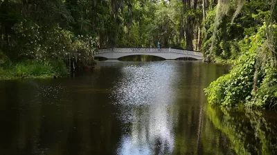
New Tool Aims to Make Parks More Resilient to Climate Change
The interactive mapping platform helps park managers understand the risks in their area and create long-term resilience plans.

Transitioning from Climate Justice Planning to Climate Justice Action
The Providence Climate Justice Plan offers an exemplary approach to prioritizing the communities and neighborhoods most impacted by the environmental effects of development and industrial pollution.

Alabama: Trump Terminates Settlements for Black Communities Harmed By Raw Sewage
Trump deemed the landmark civil rights agreement “illegal DEI and environmental justice policy.”

Study: Maui’s Plan to Convert Vacation Rentals to Long-Term Housing Could Cause Nearly $1 Billion Economic Loss
The plan would reduce visitor accommodation by 25% resulting in 1,900 jobs lost.

Planetizen Federal Action Tracker
A weekly monitor of how Trump’s orders and actions are impacting planners and planning in America.

Waymo Gets Permission to Map SF’s Market Street
If allowed to operate on the traffic-restricted street, Waymo’s autonomous taxis would have a leg up over ride-hailing competitors — and counter the city’s efforts to grow bike and pedestrian on the thoroughfare.

Parklet Symposium Highlights the Success of Shared Spaces
Parklets got a boost during the Covid-19 pandemic, when the concept was translated to outdoor dining programs that offered restaurants a lifeline during the shutdown.

Federal Homelessness Agency Places Entire Staff on Leave
The U.S. Interagency Council on Homelessness is the only federal agency dedicated to preventing and ending homelessness.
Urban Design for Planners 1: Software Tools
This six-course series explores essential urban design concepts using open source software and equips planners with the tools they need to participate fully in the urban design process.
Planning for Universal Design
Learn the tools for implementing Universal Design in planning regulations.
Caltrans
Smith Gee Studio
Institute for Housing and Urban Development Studies (IHS)
City of Grandview
Harvard GSD Executive Education
Toledo-Lucas County Plan Commissions
Salt Lake City
NYU Wagner Graduate School of Public Service