


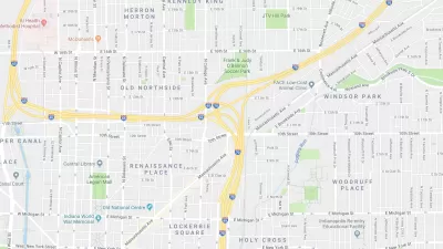
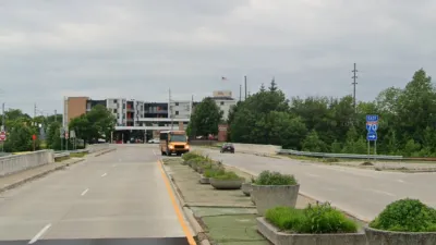
Indianapolis' I-65/I-70 inner loop, now 40 years old, made a big impact on the city.

In a story for Indianapolis Monthly, Brian D. Smith reports that the I-65/I-70 inner loop is, for better or worse, one of the most important pieces of infrastructure Indianapolis ever built.
Many of the improvements and key features of the city would never have been built if the expressway hadn't been there. Smith writes, "Without this key piece of infrastructure, there might never have been a Lucas Oil Stadium."
There have, however, been problems associated with the loop. "Just three days after the ribbon-cutting, a Noblesville truck driver lost his life near the northeast interchange on a sharp bend where three other semis had already flipped." This stretch of road known locally as "Dead Man's Curve," was eventually the subject of a $500,000 renovation for safety. Other issues were the people moved and neighborhoods disrupted, "The project displaced a total of 17,000 residents, including 6,000 from Fountain Square (one-fourth of the population)."
Today the I-65/I-70 inner loop is a defining feature of Indianapolis, for better and worse.
FULL STORY: Fruits of the Loop: An Unsung Milestone in Indy’s Downtown Development

State Plan to Expand a Downtown Indianapolis Intersection Meets Local Resistance
Local urbanists are opposing a plan to greatly expand a freeway intersection in neighborhoods adjacent to Downtown Indianapolis.
Indy Neighborhood Group Builds Temporary Multi-Use Path
Community members, aided in part by funding from the city, repurposed a vehicle lane to create a protected bike and pedestrian path for the summer season.

Indianapolis Falls Short of 2018 Goal to End Long-Term Homelessness
The city’s progress in building supportive housing units has not kept up with the rising numbers of residents experiencing homelessness.

Alabama: Trump Terminates Settlements for Black Communities Harmed By Raw Sewage
Trump deemed the landmark civil rights agreement “illegal DEI and environmental justice policy.”

Planetizen Federal Action Tracker
A weekly monitor of how Trump’s orders and actions are impacting planners and planning in America.

The 120 Year Old Tiny Home Villages That Sheltered San Francisco’s Earthquake Refugees
More than a century ago, San Francisco mobilized to house thousands of residents displaced by the 1906 earthquake. Could their strategy offer a model for the present?

Opinion: California’s SB 79 Would Improve Housing Affordability and Transit Access
A proposed bill would legalize transit-oriented development statewide.

Record Temperatures Prompt Push for Environmental Justice Bills
Nevada legislators are proposing laws that would mandate heat mitigation measures to protect residents from the impacts of extreme heat.

Downtown Pittsburgh Set to Gain 1,300 New Housing Units
Pittsburgh’s office buildings, many of which date back to the early 20th century, are prime candidates for conversion to housing.
Urban Design for Planners 1: Software Tools
This six-course series explores essential urban design concepts using open source software and equips planners with the tools they need to participate fully in the urban design process.
Planning for Universal Design
Learn the tools for implementing Universal Design in planning regulations.
Clanton & Associates, Inc.
Jessamine County Fiscal Court
Institute for Housing and Urban Development Studies (IHS)
City of Grandview
Harvard GSD Executive Education
Toledo-Lucas County Plan Commissions
Salt Lake City
NYU Wagner Graduate School of Public Service