


In a new brief, Penn IUR Faculty Fellow Richard Weller writes about mapping that recognizes the interdependence of people and conservation.
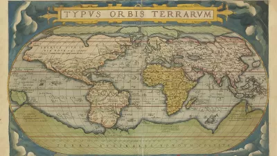
On May 20, 1570, Abraham Ortelius—book collector and engraver from Antwerp—published the world’s first Atlas: the Theatrum Orbis Terrarum (Theater of the World). With his maps Ortelius laid bare a world of healthy ecoregions ripe for exploitation. Some 450 years later, at the opposite end of modernity to Ortelius, researchers at Penn Design are building the Atlas for the End of the World— an atlas about the end of Ortelius’ world, the end of the world as a God-given and unlimited resource for human exploitation and its concomitant myths of progress.
The Atlas shows the difference between the United Nations Convention on Biological Diversity targets for achieving 17 percent global terrestrial area as protected habitat by 2020 and what is actually now protected. A new Penn IUR brief, Atlas For the End of the World: Mapping that Recognizes the Interdependence of People and Conservation, describes the measurement efforts to meet these targets by 1) mapping protected areas in the ecoregions within world’s biodiversity hotspots and calculating how much remains to meet targets, and 2) demonstrating the coming conflicts between projected city growth and biologically diverse habitat.
FULL STORY: Atlas for the End of the World


How Community Science Connects People, Parks, and Biodiversity
Community science engages people of all backgrounds in documenting local biodiversity, strengthening connections to nature, and contributing to global efforts like the City Nature Challenge to build a more inclusive and resilient future.

FEMA Resilience Program Cuts Grant Funding
The Building Resilient Infrastructure and Communities program funded projects from flood prevention to power station upgrades.
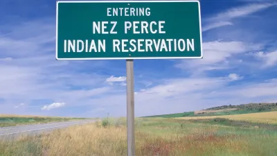
Native American Communities Prepare to Lead on Environmental Stewardship
In the face of federal threats to public lands and conservation efforts, indigenous groups continue to model nature-centered conservation efforts.

Alabama: Trump Terminates Settlements for Black Communities Harmed By Raw Sewage
Trump deemed the landmark civil rights agreement “illegal DEI and environmental justice policy.”

Planetizen Federal Action Tracker
A weekly monitor of how Trump’s orders and actions are impacting planners and planning in America.

The 120 Year Old Tiny Home Villages That Sheltered San Francisco’s Earthquake Refugees
More than a century ago, San Francisco mobilized to house thousands of residents displaced by the 1906 earthquake. Could their strategy offer a model for the present?

In Both Crashes and Crime, Public Transportation is Far Safer than Driving
Contrary to popular assumptions, public transportation has far lower crash and crime rates than automobile travel. For safer communities, improve and encourage transit travel.

Report: Zoning Reforms Should Complement Nashville’s Ambitious Transit Plan
Without reform, restrictive zoning codes will limit the impact of the city’s planned transit expansion and could exclude some of the residents who depend on transit the most.

Judge Orders Release of Frozen IRA, IIJA Funding
The decision is a victory for environmental groups who charged that freezing funds for critical infrastructure and disaster response programs caused “real and irreparable harm” to communities.
Urban Design for Planners 1: Software Tools
This six-course series explores essential urban design concepts using open source software and equips planners with the tools they need to participate fully in the urban design process.
Planning for Universal Design
Learn the tools for implementing Universal Design in planning regulations.
Clanton & Associates, Inc.
Jessamine County Fiscal Court
Institute for Housing and Urban Development Studies (IHS)
City of Grandview
Harvard GSD Executive Education
Toledo-Lucas County Plan Commissions
Salt Lake City
NYU Wagner Graduate School of Public Service