


A successful TOD will be predicated upon three core elements: 1) development; 2) transit; and 3) transit-friendly amenities. While focus tends to be on the first two elements, this article provides insights on the importance of the third element.
This article is reprinted by permission from Renewal & Redevelopment.
Often times when we think of the concept of transit-oriented development (TOD), it's the "development" portion of the term that gets the most focus.
While transit is the impetus for the concept, just read a series of news articles regarding TOD and one comes away thinking development is the driving force, with transit being just a benefit of the neighborhood.
That's not to say development isn't important, because it is critical to creating housing units, businesses, jobs and other opportunities in the neighborhood. Moreover, development has a crucial responsibility to advance transformative change in the neighborhood that enhances livability for residents, vitality of businesses and overall prosperity of the community.
As described below, a successful TOD will be predicated upon the interplay of three core elements: (1) development; (2) transit; and (3) transit-friendly amenities.
A development must consider more than just what's contained within its property lines. The context of the development site matters. The attractiveness of the streetscape and safe spaces for children, families and visitors; a business-friendly environment to support growth, employment and entrepreneurship; availability of recreational and educational amenities; and, of course, convenient access to transit facilities.
While a development by itself is not expected to strengthen the community or resolve all of its socio-economic challenges, all players involved in the development—from the developer, architect, and real estate proponents to community leaders, government officials and planners—have an obligation to ensure the project makes positive contributions that transform the neighborhood.
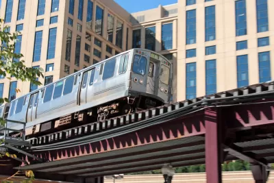
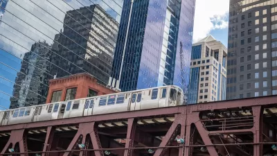
For a transit-rich urban center like the city of Chicago, community leaders and elected officials have access to a resource: The Chicago Metra Station Typology Study, which was adopted by the Plan Commission in 2014. It illustrates the varying degrees of impact that development and other site improvements will have on different types of station areas.
The Metra Typology Study provides guidance to neighborhoods in leveraging their assets and improving the physical aspects of the area around each of the 77 existing and two planned Metra commuter rail stations within the city. Building off of a similar study conducted for the Chicago Transit Authority's (CTA) "L" system, the intent of the Metra Typology Study, which was prepared by Teska Associates Inc., along with OKW Architects and Fish Transportation Group, was to incorporate transit-friendly design in new developments, guide station area improvements and improve the accessibility of transit in Chicago.
Nine Metra station typologies were classified in the study, based on data assessments evaluating characteristics such as land use, zoning, density, neighborhood character, train ridership, modes of access, frequency of service, fare zones, parking, Walk and Bike Scores, and nearby employers, cultural attractions, institutions, and business districts.
While some typologies focus on the Downtown Core and Major and Minor Activity Centers, others center around predominantly residential neighborhoods, including Dense Urban, Urban, and Low Density Neighborhoods. Employment is the emphasis of three other typologies, including Service Employment, Manufacturing Employment and Mixed Residential/Industrial, which are reflective of Chicago's railroad-based industrial heritage.
Illustrative case studies were prepared for each typology to provide general guidelines on the design of public spaces, streetscapes, potential development sites and other transit-friendly amenities. The study provides a users' guide to creating transit-friendly station areas, including identification of key community partners, formulation of transit-supportive strategies and compilation of potential financing and funding resources.
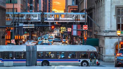
Another way to assess the desired outcomes of the strategies to balance land use and transportation is to visit Chicago's various neighborhoods that are known for their vitality and identity that are stimulated by their respective transit amenities.
For example, the Ravenswood neighborhood has evolved into one of the more prototypical TODs in Chicago, with a Metra station and access to multiple CTA bus and train lines. The Ravenswood Metra station area is characterized by a mix of public and private investments to: modernize the train station and platforms; build up the local housing stock with new for-sale and rental units; attract a Mariano's grocer, LA Fitness, and other retailers; and complete a road diet along Lawrence Avenue—the main arterial serving the train station—to create a more pedestrian- and bicycle-friendly streetscape.
While the Ravenswood example is a near textbook example of a TOD, TODs come in all shapes and size—as they should—given the unique qualities, assets, and challenges of each neighborhood.
Even though most sections of Chicago have access to transit at some level, not all have the same degree of investment, socio-economic status, and real estate draw as a neighborhood like Ravenswood. Moreover, access to transit does not always equate to transit usage, with factors like walkability/bikeability, streetscape environment, safety and station upkeep being primary influences on low-transit ridership in certain areas.
That is why a development alone will not automatically boost transit usage. The visual appeal, community amenities and other opportunities that serve residents, businesses, and visitors within the context of the development site all matter.
People want to have a unique experience with safe and convenient access to these amenities and opportunities as they traverse from the transit stop to their intended destinations in the neighborhood. From major developments to smaller site improvements, investments of all types and magnitudes are important to transform the neighborhood in positive ways that entice more investment, attract new residents and visitors alike, lure businesses to set up shop and encourage greater usage of transit.
For instance, one real estate developer in Chicago put some of its own resources towards the installation of Divvy bike share stations at two of its new apartment developments for the benefit of its residents and general public use.
Another developer set up its own wayfinding signs to direct residents to the nearby Grayland Metra station. Grassroots groups have reclaimed open space to create community gardens near Metra stations in Beverly, Ravenswood and Rogers Park, to name a few. And, neighborhood-based organizations like the Greater Auburn-Gresham Development Corporation stay active in building partnerships with the local alderman, city officials and the transit agencies as they make progress in advancing economic development and supporting the planned construction of the Auburn Park Metra station.
No one piece has the capacity to singlehandedly encourage transit ridership and enrich the dynamic character of the neighborhood at the same time. Rather, it is the sum of multiple parts that will truly create a genuine transit-oriented development and not just a development built near a transit station.
While the Chicago Metra Station Typology Study was produced specifically for the city of Chicago and its neighborhoods, the strategies and resources outlined in the study can be adapted to fit any community that seeks to facilitate transformative change of its own corridors, districts and neighborhoods with transit at their core and enriched by a strengthened array of transit-friendly amenities.
Todd Vanadilok, AICP, is a senior planner with Teska Associates, Inc., a community planning, landscape architecture, and urban design firm based in Evanston, Illinois. He can be reached at (847) 563-9725 or [email protected].
FULL STORY: Chicago TOD Strategies: Sum Of Parts Equal, Greater Than The Whole

Chicago Transit Agencies on Brink of Major Crisis
Without additional funding, regional transit agencies will be forced to cut services by 40 percent.
Chicago Transit Leaders Call for $1.5B Funding Package
Public transit across the Chicagoland region could suffer massive cuts without additional funding.
Chicago Transit Authority Announces Service Boosts Ahead of NYE
The agency says it will reach pre-pandemic service levels by the end of the year.

Alabama: Trump Terminates Settlements for Black Communities Harmed By Raw Sewage
Trump deemed the landmark civil rights agreement “illegal DEI and environmental justice policy.”

Planetizen Federal Action Tracker
A weekly monitor of how Trump’s orders and actions are impacting planners and planning in America.

The 120 Year Old Tiny Home Villages That Sheltered San Francisco’s Earthquake Refugees
More than a century ago, San Francisco mobilized to house thousands of residents displaced by the 1906 earthquake. Could their strategy offer a model for the present?

Ken Jennings Launches Transit Web Series
The Jeopardy champ wants you to ride public transit.

BLM To Rescind Public Lands Rule
The change will downgrade conservation, once again putting federal land at risk for mining and other extractive uses.

Indy Neighborhood Group Builds Temporary Multi-Use Path
Community members, aided in part by funding from the city, repurposed a vehicle lane to create a protected bike and pedestrian path for the summer season.
Urban Design for Planners 1: Software Tools
This six-course series explores essential urban design concepts using open source software and equips planners with the tools they need to participate fully in the urban design process.
Planning for Universal Design
Learn the tools for implementing Universal Design in planning regulations.
Clanton & Associates, Inc.
Jessamine County Fiscal Court
Institute for Housing and Urban Development Studies (IHS)
City of Grandview
Harvard GSD Executive Education
Toledo-Lucas County Plan Commissions
Salt Lake City
NYU Wagner Graduate School of Public Service