Zoned capacity is often as a statistic to support anti-development arguments. One write endeavors to thoroughly debunk the idea that Seattle has enough zoned capacity to meet its growing demand for housing.

Dan Bertolet writes in response to claims that Seattle has plenty of zoned capacity for new housing.
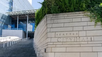
The Seattle Times editorial board argued the idea that the city is already zoned to capacity earlier in September, but as Bartolet acknowledges, the daily newspaper is far from a solitary voice on the issue. In fact, writes Bartolet, "'We have plenty of zoned capacity' is repeated credulously and earnestly by citizen activists and homeowners at city council meetings and community forums and in online debates (see here, here, here, here, here, here, here, here, here, here)."
Bartolet sets out to debunk this myth, as he describes it, perpetuated by faulty methodology for estimating zoned capacity, which he argues is "exceedingly difficult to estimate correctly and is employed by planners only as a crude yardstick." One limitation of zoned capacity is its failure to measure other real world obstacles to housing construction.
The most important point about zoned capacity, writes Bartolet, is that "in every city, zoned capacity is a side show to the main event. The main event is housing prices." [Emphasis from the original.]
Housing prices are the crux of the matter. They reveal if people have enough housing choices. If vacancy rates are low and rents and housing prices are rising, then a city needs more homes. Period. The city needs to remove zoning-code barriers to more housing, so that builders can construct more homes. Compared with the evidence of the actual housing market, zoned capacity is just fuzzy math.
Bartolet goes into a lot more detail in his effort to debunk zoned capacity, especially as it relates to housing and zoning in Seattle. Since Bartolet wrote this polemic, the city of Seattle released proposed zoning maps that would increase density in downtown and transit adjacent areas around the city.
FULL STORY: NO, SEATTLE DOES NOT ALREADY HAVE “PLENTY” OF LAND ZONED FOR NEW HOUSING

Alabama: Trump Terminates Settlements for Black Communities Harmed By Raw Sewage
Trump deemed the landmark civil rights agreement “illegal DEI and environmental justice policy.”

Planetizen Federal Action Tracker
A weekly monitor of how Trump’s orders and actions are impacting planners and planning in America.

The 120 Year Old Tiny Home Villages That Sheltered San Francisco’s Earthquake Refugees
More than a century ago, San Francisco mobilized to house thousands of residents displaced by the 1906 earthquake. Could their strategy offer a model for the present?

Ken Jennings Launches Transit Web Series
The Jeopardy champ wants you to ride public transit.

BLM To Rescind Public Lands Rule
The change will downgrade conservation, once again putting federal land at risk for mining and other extractive uses.

Indy Neighborhood Group Builds Temporary Multi-Use Path
Community members, aided in part by funding from the city, repurposed a vehicle lane to create a protected bike and pedestrian path for the summer season.
Urban Design for Planners 1: Software Tools
This six-course series explores essential urban design concepts using open source software and equips planners with the tools they need to participate fully in the urban design process.
Planning for Universal Design
Learn the tools for implementing Universal Design in planning regulations.
Clanton & Associates, Inc.
Jessamine County Fiscal Court
Institute for Housing and Urban Development Studies (IHS)
City of Grandview
Harvard GSD Executive Education
Toledo-Lucas County Plan Commissions
Salt Lake City
NYU Wagner Graduate School of Public Service


