


340 acres of vacant property, granted by the Federal Aviation Authority in the 1970s and 1980s, has a new vision for the future.
The Los Angeles City Council this week approved the LAX Northside Plan Update, "a comprehensive planning blueprint for 340 acres of vacant property located between Los Angeles International Airport (LAX) and the Los Angeles communities of Westchester and Playa del Rey."
The LAX Northside Plan Update was in the works for several years, according to a press release announcing the approval from Councilmember Mike Bonin, who represents the area. :"The plan represents a unique opportunity to achieve significant economic investment in the area and provide needed community resources and benefits, as well as important airport support sites."
After listing the standard soundbites from Councilmember Bonin, Mayor Eric Garcetti, and airport officials, the press release also included a history of the property and details of the community outreach process. Among the details of the new plan is a significant reduction in allowable density, according to the press release, from the old LAX Northside Plan drafted in the 1980s.
FULL STORY: LAX Northside Plan Approved


LA City Council Approves Extra Funding for LAX People Mover
The automated electric rail system is expected to carry up to 30 million passengers per year to points in and around the Los Angeles International Airport.
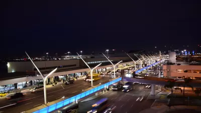
Congestion Tipping Point: Uber and Lyft Banned from LAX
Automobile traffic to LAX has increased by half in the last decade, and congestion has passed a tipping point.
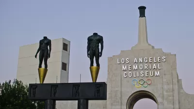
Los Angeles Investing in a Transit-Oriented Olympics
Ahead of the 2028 Olympic Games, Los Angeles is rallying around infrastructure buildout and technological advancement.

Alabama: Trump Terminates Settlements for Black Communities Harmed By Raw Sewage
Trump deemed the landmark civil rights agreement “illegal DEI and environmental justice policy.”

Planetizen Federal Action Tracker
A weekly monitor of how Trump’s orders and actions are impacting planners and planning in America.

The 120 Year Old Tiny Home Villages That Sheltered San Francisco’s Earthquake Refugees
More than a century ago, San Francisco mobilized to house thousands of residents displaced by the 1906 earthquake. Could their strategy offer a model for the present?

Ken Jennings Launches Transit Web Series
The Jeopardy champ wants you to ride public transit.

BLM To Rescind Public Lands Rule
The change will downgrade conservation, once again putting federal land at risk for mining and other extractive uses.

Indy Neighborhood Group Builds Temporary Multi-Use Path
Community members, aided in part by funding from the city, repurposed a vehicle lane to create a protected bike and pedestrian path for the summer season.
Urban Design for Planners 1: Software Tools
This six-course series explores essential urban design concepts using open source software and equips planners with the tools they need to participate fully in the urban design process.
Planning for Universal Design
Learn the tools for implementing Universal Design in planning regulations.
Clanton & Associates, Inc.
Jessamine County Fiscal Court
Institute for Housing and Urban Development Studies (IHS)
City of Grandview
Harvard GSD Executive Education
Toledo-Lucas County Plan Commissions
Salt Lake City
NYU Wagner Graduate School of Public Service