


A web tool that helped Detroit develop a housing plan may ultimately provide public data on every parcel in the country.
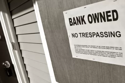
In the early stages of developing a housing recovery and blight reduction plan, a grant allowed Loveland Technologies to digitize and map information on every parcel in the city. The resulting web tool, Motor City Mapping, helped the Detroit Land Bank Authority grasp the scale of the crisis by highlighting the number of abandoned and blighted properties.
Now, with help from the Western Reserve Land Conservancy and another grant, Loveland is developing similar dashboards for the cities of Columbus, Cleveland, and Cincinnati.
The company's vision is to digitize information on every parcel in the United States—creating a publicly accessible national parcel data layer.
"By creating a one-stop shop for parcel information, civic leaders have property data at their fingertips that they can use to make smart decisions on development," the Washington Post explains, while public access to the same data creates "a more level field" for residents and neighborhood groups to advocate for community needs.
Residents can also be involved in creating the maps themselves: Loveland invites the public to help survey their city by submitting pictures and information to the dashboard via a smartphone app.
In the past, Loveland founder Jerry Paffendorf sold square-inch 'microplots' for $1 in hopes of encouraging online community engagement.
FULL STORY: One of the first steps in tackling Detroit’s housing crisis? Mapping it.


60 Years of Midwestern Urban Renewal
Researchers at the Institute for Quality Communities at the University of Oklahoma prepared a set of images to show the indelible impact of mid-20th century urban renewal on Midwestern cities.
Bike-Share Spreads Across Sprawling Midwest
Bike-share is continuing its march towards world domination, with seemingly every large Midwestern American city now jumping on the bike lending bandwagon, reports Angie Schmitt.
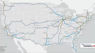
Political Support for Amtrak’s All Aboard Ohio Plans Follows Federal Infrastructure Funding
Gov. Mike DeWine’s sudden interest in working with Amtrak might have something to do with $66 billion in Infrastructure Investment and Jobs Act funding recently announced by the Federal Railroad Administration.

Alabama: Trump Terminates Settlements for Black Communities Harmed By Raw Sewage
Trump deemed the landmark civil rights agreement “illegal DEI and environmental justice policy.”

Planetizen Federal Action Tracker
A weekly monitor of how Trump’s orders and actions are impacting planners and planning in America.

The 120 Year Old Tiny Home Villages That Sheltered San Francisco’s Earthquake Refugees
More than a century ago, San Francisco mobilized to house thousands of residents displaced by the 1906 earthquake. Could their strategy offer a model for the present?

Opinion: California’s SB 79 Would Improve Housing Affordability and Transit Access
A proposed bill would legalize transit-oriented development statewide.

Record Temperatures Prompt Push for Environmental Justice Bills
Nevada legislators are proposing laws that would mandate heat mitigation measures to protect residents from the impacts of extreme heat.

Downtown Pittsburgh Set to Gain 1,300 New Housing Units
Pittsburgh’s office buildings, many of which date back to the early 20th century, are prime candidates for conversion to housing.
Urban Design for Planners 1: Software Tools
This six-course series explores essential urban design concepts using open source software and equips planners with the tools they need to participate fully in the urban design process.
Planning for Universal Design
Learn the tools for implementing Universal Design in planning regulations.
Clanton & Associates, Inc.
Jessamine County Fiscal Court
Institute for Housing and Urban Development Studies (IHS)
City of Grandview
Harvard GSD Executive Education
Toledo-Lucas County Plan Commissions
Salt Lake City
NYU Wagner Graduate School of Public Service