


A new map quantifies the stress levels for bike riders on the streets of Montgomery County, Maryland.

Just north of D.C., transportation planners in Montgomery County, Maryland have created a Bicycle Stress Map, reports Laura Bliss:
With a new Bicycle Stress Map, county planners have quantified and mapped the “traffic stress level” of the county’s bike network, assigning a numeric value and corresponding color to every street and bike trail.
Peter Furth, from Northeastern University, created the methodology for the stress map, calculating "TSL" values "based on traffic speed and volume, the number and width of car and bike lanes, parking turnover, how easy it is to get through intersections, and other characteristics," explains Bliss.
In addition to providing more detail about the methodology of the stress map, Bliss also analyzes the portrait of the Montgomery County bike network that emerges as a result. Among the most clear takeaways from the map: that the bicycle network is often most stressful around Metro stations and Capital Bikeshare stations.
FULL STORY: Mapping How Stressful Streets Can Limit Cycling

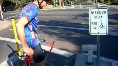
‘Idaho Stop’ Now Legal in Colorado
Colorado is the latest state to make it legal for people on bikes to treat stop signs like yield signs when no cars are in the intersection.

Colorado Legislature Approves 'Idaho Stop' Bill
Pending Gov. Polis's signature on a bill approved recently by the Colorado State Legislature, Colorado will become the latest state to allow people on bikes to yield at stop signs.

Pedestrian Planning in Response to Worsening Safety Data
Faced with rapidly deteriorating pedestrian safety statistics, Montgomery County in Maryland is getting to work on a new Pedestrian Plan, following closely on the heels of work completed for the county's Bicycle Master Plan.

Alabama: Trump Terminates Settlements for Black Communities Harmed By Raw Sewage
Trump deemed the landmark civil rights agreement “illegal DEI and environmental justice policy.”

Planetizen Federal Action Tracker
A weekly monitor of how Trump’s orders and actions are impacting planners and planning in America.

The 120 Year Old Tiny Home Villages That Sheltered San Francisco’s Earthquake Refugees
More than a century ago, San Francisco mobilized to house thousands of residents displaced by the 1906 earthquake. Could their strategy offer a model for the present?

Ken Jennings Launches Transit Web Series
The Jeopardy champ wants you to ride public transit.

BLM To Rescind Public Lands Rule
The change will downgrade conservation, once again putting federal land at risk for mining and other extractive uses.

Indy Neighborhood Group Builds Temporary Multi-Use Path
Community members, aided in part by funding from the city, repurposed a vehicle lane to create a protected bike and pedestrian path for the summer season.
Urban Design for Planners 1: Software Tools
This six-course series explores essential urban design concepts using open source software and equips planners with the tools they need to participate fully in the urban design process.
Planning for Universal Design
Learn the tools for implementing Universal Design in planning regulations.
Clanton & Associates, Inc.
Jessamine County Fiscal Court
Institute for Housing and Urban Development Studies (IHS)
City of Grandview
Harvard GSD Executive Education
Toledo-Lucas County Plan Commissions
Salt Lake City
NYU Wagner Graduate School of Public Service