


Transportation Secretary Antony Foxx called on local transit agencies earlier this month to share data to be used in building a comprehensive map of the nation's transit lines.
Faiz Siddiqui reports on the goals of the National Transit Map, i.e., "a nationwide effort to cull data from transit agencies into a comprehensive feed for anyone to use."
The initiative launched on March 8, with data collection scheduled to begin on March 31, according to a U.S. Department of Transportation website announcing the project.
According to Siddiqui, the initiative is intended to help pinpoint transit deserts, and "use the information to help persuade policymakers to improve public transportation in underserved communities."
The article includes more of the technical details of the data request, potential applications of the data the U.S. DOT hopes to collect in the process, and more background on the nation's transit deserts and their impacts on economic mobility.
FULL STORY: How a National Transit Map could connect ‘transit deserts’ to the grid

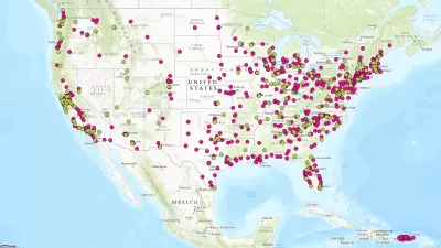
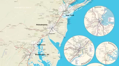
Hot Off the Press: The National Transit Map
The U.S. Department of Transit has released its first ever National Transit Map.
Beyond Congestion Pricing: Strategies for Revolutionizing Urban Mobility
How cities are leveraging data and technology to improve their transportation networks and reduce traffic.

What the Proposed Federal Budget Means for Transit, Rail
The proposed FY 2025 budget keeps spending for public transit and passenger rail essentially the same as in 2024.

Trump Administration Could Effectively End Housing Voucher Program
Federal officials are eyeing major cuts to the Section 8 program that helps millions of low-income households pay rent.

Planetizen Federal Action Tracker
A weekly monitor of how Trump’s orders and actions are impacting planners and planning in America.

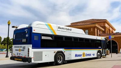
Ken Jennings Launches Transit Web Series
The Jeopardy champ wants you to ride public transit.

Crime Continues to Drop on Philly, San Francisco Transit Systems
SEPTA and BART both saw significant declines in violent crime in the first quarter of 2025.

How South LA Green Spaces Power Community Health and Hope
Green spaces like South L.A. Wetlands Park are helping South Los Angeles residents promote healthy lifestyles, build community, and advocate for improvements that reflect local needs in historically underserved neighborhoods.

Sacramento Plans ‘Quick-Build’ Road Safety Projects
The city wants to accelerate small-scale safety improvements that use low-cost equipment to make an impact at dangerous intersections.
Urban Design for Planners 1: Software Tools
This six-course series explores essential urban design concepts using open source software and equips planners with the tools they need to participate fully in the urban design process.
Planning for Universal Design
Learn the tools for implementing Universal Design in planning regulations.
Heyer Gruel & Associates PA
Ada County Highway District
Institute for Housing and Urban Development Studies (IHS)
City of Grandview
Harvard GSD Executive Education
Toledo-Lucas County Plan Commissions
Salt Lake City
NYU Wagner Graduate School of Public Service