


Containing more than 500 open datasets, GeoHub lets users access the wealth of data Los Angeles makes available. The tool is also intended to help employees from different city departments work together.
Early this year, the city of Los Angeles made public a new data visualization tool called GeoHub. Josh Cohen writes, "GeoHub is a searchable directory of over 500 eclectic L.A. city datasets such as farmers markets, emergency services, construction projects, streams and rivers, volunteer opportunities, crime, performing arts centers, and many more."
Catherine Geanuracos, a civic hacker and member of L.A.'s innovation and performance commison, remarked, "'When Mayor Garcetti took office, he started moving forward with open data. This is the next step on that from the city.'" Geanuracos went on, "The city of L.A. has been extremely siloed. Anything that prompts collaboration will be really valuable for the city overall, whether it's planning or evaluation."
L.A.'s deputy chief data officer Lillian Coral hopes GeoHub can be useful to an "engaged citizenry" of journalists, advocates, and others who may lack the time or technical acumen to decipher open data in its raw form.
FULL STORY: L.A. Opens Up More With New Data Tool

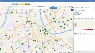
Presenting Municipal Data in an Interactive Map, Nashville Style
The city of Nashville launched the NashView interactive data map earlier this month.

DataUSA: An Intuitive Tool for Public Data
A collaboration between Deloitte, Datawheel, and MIT has produced an intuitive aesthetically-pleasing gathering point for public data in the United States. Specific locations and industries boast easy-to-read profiles.

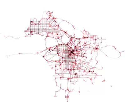
Mapping the Age of Every Building in Los Angeles
Developed using open data from local government sources, built: LA is a mapping tool that displays the age of every building in the county. Much of the area's built environment is surprisingly old.

Alabama: Trump Terminates Settlements for Black Communities Harmed By Raw Sewage
Trump deemed the landmark civil rights agreement “illegal DEI and environmental justice policy.”

Study: Maui’s Plan to Convert Vacation Rentals to Long-Term Housing Could Cause Nearly $1 Billion Economic Loss
The plan would reduce visitor accommodation by 25% resulting in 1,900 jobs lost.

Planetizen Federal Action Tracker
A weekly monitor of how Trump’s orders and actions are impacting planners and planning in America.

Wind Energy on the Rise Despite Federal Policy Reversal
The Trump administration is revoking federal support for renewable energy, but demand for new projects continues unabated.

Passengers Flock to Caltrain After Electrification
The new electric trains are running faster and more reliably, leading to strong ridership growth on the Bay Area rail system.

Texas Churches Rally Behind ‘Yes in God’s Back Yard’ Legislation
Religious leaders want the state to reduce zoning regulations to streamline leasing church-owned land to housing developers.
Urban Design for Planners 1: Software Tools
This six-course series explores essential urban design concepts using open source software and equips planners with the tools they need to participate fully in the urban design process.
Planning for Universal Design
Learn the tools for implementing Universal Design in planning regulations.
Caltrans
Smith Gee Studio
Institute for Housing and Urban Development Studies (IHS)
City of Grandview
Harvard GSD Executive Education
Toledo-Lucas County Plan Commissions
Salt Lake City
NYU Wagner Graduate School of Public Service