


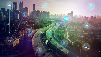
It's easy to think of GPS technology as a personal navigation device, but the potential for a faster, cheaper GPS technology extends deep into the emerging Internet of Things.
Aarian Marshall reports on a breakthrough in GPS technology that will improve the performance of GPS for the masses—on their mobile phones, of course.
Marshall begins the article by noting that GPS technology is much more accurate than anyone who only uses a smart phone realizes:
Surveyors have used GPS to measure down to the centimeter for some time now. More precise GPS identifies signals at a higher frequency, called the carrier phase, but must use complex bits of mathematics to figure out locations. The problem is that this process is slow, and speeding it up to make it widely available to the public is expensive.
Enter Ray Farrell, a professor and electrical and computer engineering chair at the Bourns College of Engineering at the University of California, Riverside, who along with some colleagues published a paper in the journal IEEE, which describes a breakthrough in "[combining] GPS measurements with data from an inertial measurement unit, or IMU, which is an electronic device that can measure force and angular velocity."
Marshall describes in additional detail the technological advancement discovered by the team of engineers, but the notable result of their work: "very precise GPS just got a lot faster, and a lot cheaper." Beyond the personal applications possible with the new technology, Farrell and team focus mostly on the Internet of things: specifically the sensors that will be necessary to drive a fleet of automated vehicles.
FULL STORY: Super-Accurate GPS Just Got a Lot Cheaper and Faster


Smart Cities and Utilities: Enhancing Energy Efficiency Through IoT Integration
Learn how IoT integration in utilities is boosting energy efficiency in smart cities, aiding urban planners in sustainable development.
How Smart Cities Influence Real Estate Investment
By integrating technology and infrastructure, smart cities are attracting investors with their potential for improved quality of life, efficient resource management, and innovative urban development projects.

Toyota Working on the Smartest City Yet, Built From Scratch
Checking in with Toyota's plans for an interconnected smart "city of the future" means considering how their approach might differ from other attempts at similar projects.

Alabama: Trump Terminates Settlements for Black Communities Harmed By Raw Sewage
Trump deemed the landmark civil rights agreement “illegal DEI and environmental justice policy.”

Planetizen Federal Action Tracker
A weekly monitor of how Trump’s orders and actions are impacting planners and planning in America.

The 120 Year Old Tiny Home Villages That Sheltered San Francisco’s Earthquake Refugees
More than a century ago, San Francisco mobilized to house thousands of residents displaced by the 1906 earthquake. Could their strategy offer a model for the present?

Ken Jennings Launches Transit Web Series
The Jeopardy champ wants you to ride public transit.

BLM To Rescind Public Lands Rule
The change will downgrade conservation, once again putting federal land at risk for mining and other extractive uses.

Indy Neighborhood Group Builds Temporary Multi-Use Path
Community members, aided in part by funding from the city, repurposed a vehicle lane to create a protected bike and pedestrian path for the summer season.
Urban Design for Planners 1: Software Tools
This six-course series explores essential urban design concepts using open source software and equips planners with the tools they need to participate fully in the urban design process.
Planning for Universal Design
Learn the tools for implementing Universal Design in planning regulations.
Clanton & Associates, Inc.
Jessamine County Fiscal Court
Institute for Housing and Urban Development Studies (IHS)
City of Grandview
Harvard GSD Executive Education
Toledo-Lucas County Plan Commissions
Salt Lake City
NYU Wagner Graduate School of Public Service