


OpenGrid gathers together Chicago's open data, letting users specify areas of focus on a map of the city. Users can also overlay different datasets on the same map.

Chicago's open data community have already created tools to curate what the city makes public. OpenGrid is an effort by the city to collect that data and make it more accessible. Whet Moser writes, "It's an interface for the city's open data that allows users to run their searches off a map, creating their own geographies as they go and mashing up data as they wish."
Prior to OpenGrid, the city used a similar tool called WindyGrid to help plan events, services, and public safety. "With backing from Bloomberg Philanthropies and hosting by the Smart Chicago Collaborative, the city built a public version—OpenGrid—atop Plenar.io, an open-source infrastructure for open data."
Brenna Berman, Chicago's chief information officer, sees OpenGrid as a way for researchers to define neighborhoods and communities independently from official distinctions. "'Lots of people, the neighborhood that they recognize is not in their ward or community area,' Berman says. 'The polygon that I'd draw crosses two wards and community areas. These formal things are not where we live.'"
FULL STORY: Want Chicago Data? OpenGrid Makes It Easier Than Ever

A Website to Report and Map Street Repair Work
The ChiSreetWork website, which updates the location of street repairs and was originally intended for internal use at City Hall, is now publicly available in Chicago.

First City to Make Ride-Hailing Trip Data Public: Chicago
Data geeks in Chicago will get the first chance to crunch detailed data on transportation network company trips in their city.
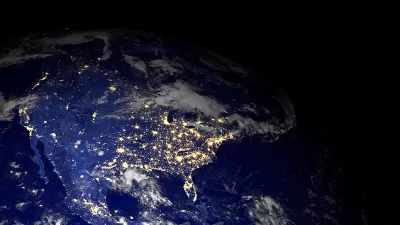
DataUSA: An Intuitive Tool for Public Data
A collaboration between Deloitte, Datawheel, and MIT has produced an intuitive aesthetically-pleasing gathering point for public data in the United States. Specific locations and industries boast easy-to-read profiles.

Alabama: Trump Terminates Settlements for Black Communities Harmed By Raw Sewage
Trump deemed the landmark civil rights agreement “illegal DEI and environmental justice policy.”

Planetizen Federal Action Tracker
A weekly monitor of how Trump’s orders and actions are impacting planners and planning in America.

The 120 Year Old Tiny Home Villages That Sheltered San Francisco’s Earthquake Refugees
More than a century ago, San Francisco mobilized to house thousands of residents displaced by the 1906 earthquake. Could their strategy offer a model for the present?

Ken Jennings Launches Transit Web Series
The Jeopardy champ wants you to ride public transit.

BLM To Rescind Public Lands Rule
The change will downgrade conservation, once again putting federal land at risk for mining and other extractive uses.

Indy Neighborhood Group Builds Temporary Multi-Use Path
Community members, aided in part by funding from the city, repurposed a vehicle lane to create a protected bike and pedestrian path for the summer season.
Urban Design for Planners 1: Software Tools
This six-course series explores essential urban design concepts using open source software and equips planners with the tools they need to participate fully in the urban design process.
Planning for Universal Design
Learn the tools for implementing Universal Design in planning regulations.
Clanton & Associates, Inc.
Jessamine County Fiscal Court
Institute for Housing and Urban Development Studies (IHS)
City of Grandview
Harvard GSD Executive Education
Toledo-Lucas County Plan Commissions
Salt Lake City
NYU Wagner Graduate School of Public Service