


San Diego's downtown, dominated by 3-lane one-way streets engineered to maximize car velocity and traffic flow, may be getting redesigned to make it hospitable for bicyclists and pedestrians.
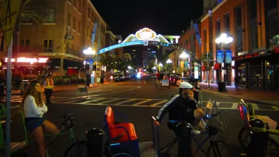
Downtown San Diego's street grid could have made Jane Jacobs proud with its short blocks and multiple cross-streets. Unfortunately, most of that public right of way has been engineered solely for automobile-mobility, with one-way three-lane streets, timed traffic lights, the resultant high speed traffic, parallel parking, and aggressive (and costly) jaywalking enforcement. The auto-oriented street grid leaves little room for cyclists and is inhospitable for walkers, despite the fact that Downtown San Diego's small blocks and concomitant greater number of streets leave ample room to accommodate all modes of mobility.
All that could soon change. The city has issued a draft of the Downtown San Diego Mobility Plan, years in the making, "with a goal of reducing travel by car and increasing trips by bike and foot" writes dedicated downtown urbanist Bill Keller. Among the features contained in the plan,
Perhaps the most ambitious idea is the network of Bike Paths, Lanes, Routes and Cycle Tracks detailed in Chapter 5 Bicycling. For example, a two-way cycle track separated from traffic would run along the west side of Sixth Ave from Beech St down to L St. Cycle tracks are also proposed along sections of Pacific Highway, State St, Park Blvd, Grape St, Hawthorne, Beech, Broadway, C St, and J St.
A public workshop is scheduled for February 23rd and the public review period is open until March 11, 2016. Comments may be submitted at the Mobility Plan website.
FULL STORY: Downtown San Diego Mobility Plan — Draft Released


Alabama: Trump Terminates Settlements for Black Communities Harmed By Raw Sewage
Trump deemed the landmark civil rights agreement “illegal DEI and environmental justice policy.”

Planetizen Federal Action Tracker
A weekly monitor of how Trump’s orders and actions are impacting planners and planning in America.

The 120 Year Old Tiny Home Villages That Sheltered San Francisco’s Earthquake Refugees
More than a century ago, San Francisco mobilized to house thousands of residents displaced by the 1906 earthquake. Could their strategy offer a model for the present?

Indy Neighborhood Group Builds Temporary Multi-Use Path
Community members, aided in part by funding from the city, repurposed a vehicle lane to create a protected bike and pedestrian path for the summer season.

Congestion Pricing Drops Holland Tunnel Delays by 65 Percent
New York City’s contentious tolling program has yielded improved traffic and roughly $100 million in revenue for the MTA.

In Both Crashes and Crime, Public Transportation is Far Safer than Driving
Contrary to popular assumptions, public transportation has far lower crash and crime rates than automobile travel. For safer communities, improve and encourage transit travel.
Urban Design for Planners 1: Software Tools
This six-course series explores essential urban design concepts using open source software and equips planners with the tools they need to participate fully in the urban design process.
Planning for Universal Design
Learn the tools for implementing Universal Design in planning regulations.
Clanton & Associates, Inc.
Jessamine County Fiscal Court
Institute for Housing and Urban Development Studies (IHS)
City of Grandview
Harvard GSD Executive Education
Toledo-Lucas County Plan Commissions
Salt Lake City
NYU Wagner Graduate School of Public Service