


A new scorecard, called "Freeing the Grid," evaluates states on the incentives they offer homeowners and businesses to install rooftop solar.
Julian Spector shares news of the "Freeing the Grid" scorecard, released earlier this week by the Interstate Renewable Energy Council. According to Spector, the scorecard is helpful in determining the answer to the questions: "How difficult is it to connect to the energy grid, and how will you be compensated for the electricity your panels produce?"
More specifically, according to Spector, the scorecard "serves as a handy tracker for the growth of policies that promote 'net metering' (which compensates homegrown energy producers for the surplus electricity they pump back into the grid) and 'interconnection' (which is the technical term for the logistics involved in actually hooking up a renewable energy project to the grid)."
The article also includes a look at the interactive map that accompanies the report, as well as Spector's quick take on the answers to the aforementioned questions, depending on where prospective solar customers live.
FULL STORY: The Best and Worst States for Rooftop Solar Panels


Local Opposition Threatens to Cripple Solar Expansion
A bevy of real and unfounded claims against solar farms is feeding a growing opposition movement in rural areas.
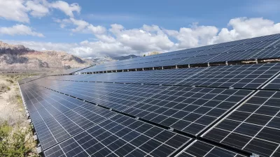
Solar Farm Moratorium to End, Despite Local Concerns
Delaware County plans to amend its solar zoning ordinance and lift a moratorium on the construction of new solar farms that was implemented after local opposition stalled the project.

New Renewable Energy Has Yet to Displace Dirty Energy
Falling costs for renewable energy may lead some to believe that coal and other mainstays have been replaced, but they haven't. Adoption of renewables is not yet outpacing growth in demand for energy.

Alabama: Trump Terminates Settlements for Black Communities Harmed By Raw Sewage
Trump deemed the landmark civil rights agreement “illegal DEI and environmental justice policy.”

Planetizen Federal Action Tracker
A weekly monitor of how Trump’s orders and actions are impacting planners and planning in America.

The 120 Year Old Tiny Home Villages That Sheltered San Francisco’s Earthquake Refugees
More than a century ago, San Francisco mobilized to house thousands of residents displaced by the 1906 earthquake. Could their strategy offer a model for the present?

Ken Jennings Launches Transit Web Series
The Jeopardy champ wants you to ride public transit.

BLM To Rescind Public Lands Rule
The change will downgrade conservation, once again putting federal land at risk for mining and other extractive uses.

Indy Neighborhood Group Builds Temporary Multi-Use Path
Community members, aided in part by funding from the city, repurposed a vehicle lane to create a protected bike and pedestrian path for the summer season.
Urban Design for Planners 1: Software Tools
This six-course series explores essential urban design concepts using open source software and equips planners with the tools they need to participate fully in the urban design process.
Planning for Universal Design
Learn the tools for implementing Universal Design in planning regulations.
Clanton & Associates, Inc.
Jessamine County Fiscal Court
Institute for Housing and Urban Development Studies (IHS)
City of Grandview
Harvard GSD Executive Education
Toledo-Lucas County Plan Commissions
Salt Lake City
NYU Wagner Graduate School of Public Service