


A new study quantifies the amount of space devoted to parking in Los Angeles County—a figure that just begs to be visualized.
A recently released study in the Journal of the American Planning Association did an inventory on parking spaces in Los Angeles County—tracking the proliferation of parking across the county between 1900 and 2010. The big headline of the post: 14 percent of incorporated land in Los Angeles County is committed to parking. A stand-alone website for the study provides an abstract, of sorts, for the study, showing heat maps of parking (residential offstreet, non-residential offstreet, and total) around the county at 20 year intervals beginning with 1950.
Blogger Shane Phillips followed on the study to coalesce the data provided by the study into a nifty infographic that drives the point home a little more clearly. Phillips images all of that parking as one large parking crater—16 miles in diameter and taking up an area spanning East L.A. to Santa Monica. In real life, the area inside that parking crater fits 2.3 million residents, 900,000 homes, and 1 million workers, according to Phillips's calculations.
FULL STORY: Mapped: All 200 Square Miles of Parking in LA County, As One Giant Parking Lot


How Cities Are Slimming Down on Parking
Cities around the world are finding ways to go on a parking diet, freeing up unused space. San Francisco and Philadelphia are two U.S. leaders, while cities like Paris, Copenhagen, and Zurich pursue even more aggressive measures.
Unlocking the Curb Conundrum: How to Solve Our Parking Crisis
For Alan Durning, curb-parking territoriality is the root cause of many of America's urban ills, from housing affordability to economic vitality. He describes the circumstances that've led to the current state of affairs and introduces the way out.
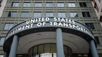
Has Anyone at USDOT Read Donald Shoup?
USDOT employees, who are required to go back to the office, will receive free parking at the agency’s D.C. offices — flying in the face of a growing research body that calls for pricing parking at its real value.

Alabama: Trump Terminates Settlements for Black Communities Harmed By Raw Sewage
Trump deemed the landmark civil rights agreement “illegal DEI and environmental justice policy.”

Planetizen Federal Action Tracker
A weekly monitor of how Trump’s orders and actions are impacting planners and planning in America.

The 120 Year Old Tiny Home Villages That Sheltered San Francisco’s Earthquake Refugees
More than a century ago, San Francisco mobilized to house thousands of residents displaced by the 1906 earthquake. Could their strategy offer a model for the present?

In Both Crashes and Crime, Public Transportation is Far Safer than Driving
Contrary to popular assumptions, public transportation has far lower crash and crime rates than automobile travel. For safer communities, improve and encourage transit travel.

Report: Zoning Reforms Should Complement Nashville’s Ambitious Transit Plan
Without reform, restrictive zoning codes will limit the impact of the city’s planned transit expansion and could exclude some of the residents who depend on transit the most.

Judge Orders Release of Frozen IRA, IIJA Funding
The decision is a victory for environmental groups who charged that freezing funds for critical infrastructure and disaster response programs caused “real and irreparable harm” to communities.
Urban Design for Planners 1: Software Tools
This six-course series explores essential urban design concepts using open source software and equips planners with the tools they need to participate fully in the urban design process.
Planning for Universal Design
Learn the tools for implementing Universal Design in planning regulations.
Clanton & Associates, Inc.
Jessamine County Fiscal Court
Institute for Housing and Urban Development Studies (IHS)
City of Grandview
Harvard GSD Executive Education
Toledo-Lucas County Plan Commissions
Salt Lake City
NYU Wagner Graduate School of Public Service