


A 1.5-acre park in Cleveland should be ready in time for the 2016 Republican National Convention. The small park is just the first step, however, toward a much grander vision for a corner of Cleveland with deep connections to the city's past.
The first step toward a grand vision for the Canal Basin Park is underway in Cleveland. Steven Litt reports about the current planning for a park project on 1.5 acres of what will eventually become 20 acres of ambitiously designed park space.
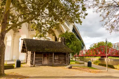
The 1.5-acre park currently underway with planning will be "located near the intersection of Center Street and Merwin Avenue on the east bank of the Flats," reports Litt. For now, Cleveland Metroparks will use $300,000 in tax increment financing to "install grass, walking paths and trees on the 1.5-acre parcel, connecting Columbus Road and Center Street down to Heritage Park on Cuyahoga River." A parking lot will also be removed.
Litt notes that the park's location "may be obscure geography to some Clevelanders, but it wasn't in the past and won't be in the future." And the future, signified by the plans for Canal Basin Park, could be on its way much faster now. The city's Planning Commission scheduled to review the park's framework plan later in November.
The name Canal Basin indicates the site's importance in Cleveland history. As Litt notes, the "larger park will mark the northern terminus of the 110-mile Towpath Trail, and focus fresh attention on the original northern end of the Ohio & Erie Canal, completed in 1832."
FULL STORY: Metroparks plans "greening" for 1.5-acres of the future 20-acre Canal Basin Park (photos)

Not a Walk in the Park: What It Really Takes to Build Green Spaces
Park creation can take decades of perseverance to overcome financial, regulatory, and social hurdles, but the end result for the local community is more than worth it.
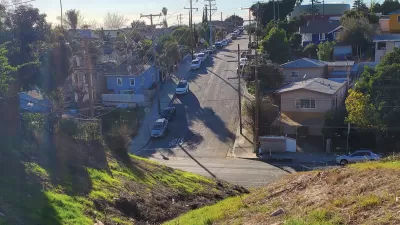
Envisioning a New Park in East Los Angeles
Los Angeles County is working towards transforming underutilized land into a vibrant pocket park in the City Terrace neighborhood of East LA.

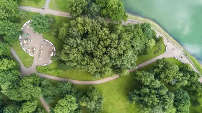
Using Cellphone and Fitness App Data for Park Planning
Data from smartphone apps and fitness trackers are helping planners to better understand park usage patterns and plan for new and improved parks.

Alabama: Trump Terminates Settlements for Black Communities Harmed By Raw Sewage
Trump deemed the landmark civil rights agreement “illegal DEI and environmental justice policy.”

Planetizen Federal Action Tracker
A weekly monitor of how Trump’s orders and actions are impacting planners and planning in America.

The 120 Year Old Tiny Home Villages That Sheltered San Francisco’s Earthquake Refugees
More than a century ago, San Francisco mobilized to house thousands of residents displaced by the 1906 earthquake. Could their strategy offer a model for the present?

BLM To Rescind Public Lands Rule
The change will downgrade conservation, once again putting federal land at risk for mining and other extractive uses.

Indy Neighborhood Group Builds Temporary Multi-Use Path
Community members, aided in part by funding from the city, repurposed a vehicle lane to create a protected bike and pedestrian path for the summer season.

Congestion Pricing Drops Holland Tunnel Delays by 65 Percent
New York City’s contentious tolling program has yielded improved traffic and roughly $100 million in revenue for the MTA.
Urban Design for Planners 1: Software Tools
This six-course series explores essential urban design concepts using open source software and equips planners with the tools they need to participate fully in the urban design process.
Planning for Universal Design
Learn the tools for implementing Universal Design in planning regulations.
Clanton & Associates, Inc.
Jessamine County Fiscal Court
Institute for Housing and Urban Development Studies (IHS)
City of Grandview
Harvard GSD Executive Education
Toledo-Lucas County Plan Commissions
Salt Lake City
NYU Wagner Graduate School of Public Service