


Not all transit maps are created equal. The new Portland TriMet map, for instance, does a much better job of illustrating the usefulness of its high-frequency network.
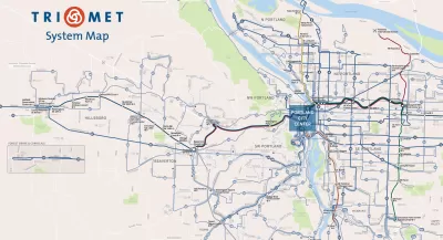
Evan Landman writes a post explain the importance of quality mapping to illustrate the frequent service routes in a bus system. To do so, Landman focuses on the city of Portland:
"Portland's agency TriMet has traditionally been a best practice example here, given their extensive Frequent Network branding down to the individual stop level, but curiously, their system map has not embraced this idea so wholeheartedly. Today, TriMet's new system map [pdf] changes that, introducing a cleaner, more readable map, which does a much better job of highlighting the agency's premier bus services."
The post goes on to describe how the design details have changed between the old map and the new. To summarize the key success of the new map: "This is a map that truly focuses on communicating the usefulness of the transit routes. The most important factor for usefulness is frequency, which is obscured when every line on the map is the same color, or a different color, or colored by a less important attribute, like which corner of the city it serves. "
FULL STORY: Portland: New Transit Map Underscores Frequent Network

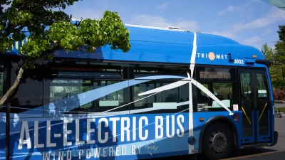
TriMet Ridership Grows Thanks to Realignment, Schedule Changes
The agency’s response to post-pandemic changes in travel behavior is paying off.
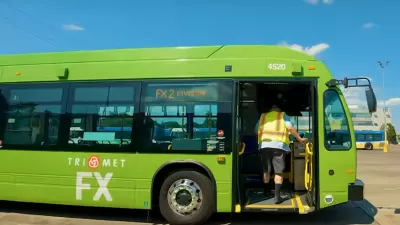
Portland ‘BRT Light’ Line Shows Promise
Despite not having fully dedicated bus lanes, Portland’s new ‘light’ bus rapid transit line is significantly reducing travel times.
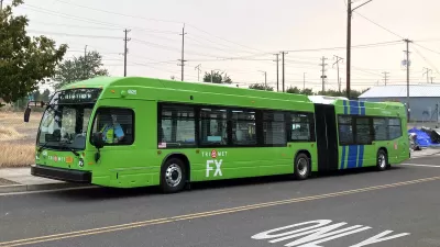
Portland ‘Frequent Express’ Bus Speeding Travel Times
TriMet’s newest line is improving service and reducing travel times for riders as ridership slowly recovers.

Alabama: Trump Terminates Settlements for Black Communities Harmed By Raw Sewage
Trump deemed the landmark civil rights agreement “illegal DEI and environmental justice policy.”

Study: Maui’s Plan to Convert Vacation Rentals to Long-Term Housing Could Cause Nearly $1 Billion Economic Loss
The plan would reduce visitor accommodation by 25% resulting in 1,900 jobs lost.

Planetizen Federal Action Tracker
A weekly monitor of how Trump’s orders and actions are impacting planners and planning in America.

Waymo Gets Permission to Map SF’s Market Street
If allowed to operate on the traffic-restricted street, Waymo’s autonomous taxis would have a leg up over ride-hailing competitors — and counter the city’s efforts to grow bike and pedestrian on the thoroughfare.

Parklet Symposium Highlights the Success of Shared Spaces
Parklets got a boost during the Covid-19 pandemic, when the concept was translated to outdoor dining programs that offered restaurants a lifeline during the shutdown.

Federal Homelessness Agency Places Entire Staff on Leave
The U.S. Interagency Council on Homelessness is the only federal agency dedicated to preventing and ending homelessness.
Urban Design for Planners 1: Software Tools
This six-course series explores essential urban design concepts using open source software and equips planners with the tools they need to participate fully in the urban design process.
Planning for Universal Design
Learn the tools for implementing Universal Design in planning regulations.
Caltrans
Smith Gee Studio
Institute for Housing and Urban Development Studies (IHS)
City of Grandview
Harvard GSD Executive Education
Toledo-Lucas County Plan Commissions
Salt Lake City
NYU Wagner Graduate School of Public Service