


A team of designers will convert one Mexico City's most dangerous highways into an urban oasis.
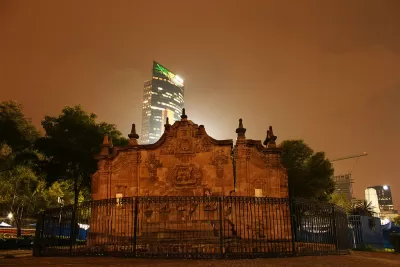
Centuries ago, Avenida Chapultepec was a canal dividing indigenous groups in the Aztec empire. Today, with only remnants of an abandoned aqueduct and Mexico City's oldest fountain, the wide avenue passes through the trendy neighborhoods of Roma and La Condesa, heading east from Chapultepec Park to the colonial and commercial center of the city.
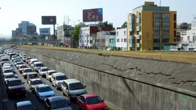
With one of the highest traffic accident rates for pedestrians, cyclists, and automobile drivers, the 10-lane highway is ripe for renovation. The city has hired a team of designers, led by Fernando Romero of FR-EE, to overhaul the busy street into a multi-level, green oasis for the city of 20 million. Romero's design for the thoroughfare draws inspiration from the history of water as a fundamental presence in the space. “We thought it would be nice to create a geometry based on the fluidity of water, creating a pedestrian connection among the city's various cultural contexts in the most efficient and seamless way,” says Romero.
Heading west, the avenue will include a gradual inclination to a pedestrian-only elevated path with retail shops and an outdoor amphitheater. Along with troughs of water, and dedicated bike and bus lanes, the team plans to drastically increase the share of the avenue for pedestrians and double the number of trees. "The new avenue is designed to create a sense of discovery, pulling people through to enjoy the safe passage to the views, trees, and public spaces," writes Jared Green.
FULL STORY: Mexico City’s Ambitious Elevated Park

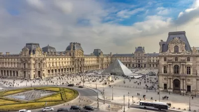
Paris Creates Limited Traffic Zone in City Center
Most vehicles will be barred from entering a 5.5 square kilometer zone to limit traffic, noise, and pollution.
Gondola Monorail Could Ease Mexico City Traffic
Mexico City is considering a novel transit idea: two-person gondolas gliding along an aerial track. The costs of such a system may be far lower than extending the subway system.
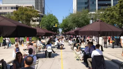
How Did Vancouver Decrease its Traffic While Growing its Population?
With its elegant skyline, walkable streets and stunning parks, Vancouver exemplifies great city-making. Add to the list of achievements the city's ability to reduce traffic by 20 to 30 percent since 2006 while growing its population by 4.5 percent.

Alabama: Trump Terminates Settlements for Black Communities Harmed By Raw Sewage
Trump deemed the landmark civil rights agreement “illegal DEI and environmental justice policy.”

Planetizen Federal Action Tracker
A weekly monitor of how Trump’s orders and actions are impacting planners and planning in America.

The 120 Year Old Tiny Home Villages That Sheltered San Francisco’s Earthquake Refugees
More than a century ago, San Francisco mobilized to house thousands of residents displaced by the 1906 earthquake. Could their strategy offer a model for the present?

BLM To Rescind Public Lands Rule
The change will downgrade conservation, once again putting federal land at risk for mining and other extractive uses.

Indy Neighborhood Group Builds Temporary Multi-Use Path
Community members, aided in part by funding from the city, repurposed a vehicle lane to create a protected bike and pedestrian path for the summer season.

Congestion Pricing Drops Holland Tunnel Delays by 65 Percent
New York City’s contentious tolling program has yielded improved traffic and roughly $100 million in revenue for the MTA.
Urban Design for Planners 1: Software Tools
This six-course series explores essential urban design concepts using open source software and equips planners with the tools they need to participate fully in the urban design process.
Planning for Universal Design
Learn the tools for implementing Universal Design in planning regulations.
Clanton & Associates, Inc.
Jessamine County Fiscal Court
Institute for Housing and Urban Development Studies (IHS)
City of Grandview
Harvard GSD Executive Education
Toledo-Lucas County Plan Commissions
Salt Lake City
NYU Wagner Graduate School of Public Service