


According to a new rule, developers building over known faults will need to drill or take samples to find the rift's exact position. While it slows down construction, the measure might prevent catastrophic future quake damage.
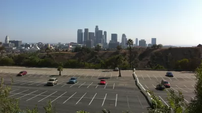
Drought resilience may be a hot topic these days in Southern California, but that doesn't mean an old threat has vanished. A new rule in Los Angeles stipulates that "developers looking to build a new structure in [earthquake risk] spots must first prove they won't be doing so on top of a dangerous fault, according to Ashley Atkinson with Mayor Eric Garcetti's Office."
The rule only applies to faults already mapped by the California Geological Survey. However, "the state doesn't have the funds it would need to map every potentially dangerous fault, leaving a number of well-known faults unmapped, including several in Los Angeles."
This safety measure may put a damper on some projects, but shouldn't prove too difficult a hurdle. From the article: "The new rules will likely slow down some future projects since digging to look for a fault — or 'trenching' as it's known — is time-consuming and can cost tens of thousands of dollars. However, some developers might be able to provide enough evidence by drilling for core samples, Atkinson explained, which is a less involved process."
FULL STORY: LA developers in quake prone-areas must now look for faults first

Want an Earthquake Warning? There's an App for That
A new earthquake warning system is in place in the city of Los Angeles.
Los Angeles Resiliency Strategy Looks Beyond 'The Big One'
Renewable energy, sea-level rise, and, of course, seismic safety are all part of the plan.
Lessons on Resilience and Recovery from 2017's Worst Disasters
Dissecting successful disaster response in places like Houston and Mexico City could help California prepare for the inevitable.

Alabama: Trump Terminates Settlements for Black Communities Harmed By Raw Sewage
Trump deemed the landmark civil rights agreement “illegal DEI and environmental justice policy.”

Planetizen Federal Action Tracker
A weekly monitor of how Trump’s orders and actions are impacting planners and planning in America.

The 120 Year Old Tiny Home Villages That Sheltered San Francisco’s Earthquake Refugees
More than a century ago, San Francisco mobilized to house thousands of residents displaced by the 1906 earthquake. Could their strategy offer a model for the present?

Ken Jennings Launches Transit Web Series
The Jeopardy champ wants you to ride public transit.

BLM To Rescind Public Lands Rule
The change will downgrade conservation, once again putting federal land at risk for mining and other extractive uses.

Indy Neighborhood Group Builds Temporary Multi-Use Path
Community members, aided in part by funding from the city, repurposed a vehicle lane to create a protected bike and pedestrian path for the summer season.
Urban Design for Planners 1: Software Tools
This six-course series explores essential urban design concepts using open source software and equips planners with the tools they need to participate fully in the urban design process.
Planning for Universal Design
Learn the tools for implementing Universal Design in planning regulations.
Clanton & Associates, Inc.
Jessamine County Fiscal Court
Institute for Housing and Urban Development Studies (IHS)
City of Grandview
Harvard GSD Executive Education
Toledo-Lucas County Plan Commissions
Salt Lake City
NYU Wagner Graduate School of Public Service