


Interested in finding the road less traveled by? Walkonomics has launched in seven cities around the globe.

"Those interested in finding the most beautiful, walkable route to their destination can now try Walkonomics," reports Liz Camuti. " The app, created by United Kingdom programmer Adam Davies, allows users to find more beautiful paths through seven cities across the globe using both open and crowd-sourced city data."
The app is available for Android and iOS, and works in Central London, Paris, New York, San Francisco, Toronto, Buenos Aires, and Glasgow. To help users chose the most pedestrian-friendly and beautiful routes, "[t]he app provides star rankings for eight different categories of pedestrian-friendliness: road safety; easy to cross; pavement/sidewalk; hilliness; navigation; fear of crime; 'smart & beautiful;' and 'fun & relaxing.'"
Camuti also explains more about how the app works: "These ratings are generated from open data including street widths, traffic levels, crime statistics, pedestrian accidents, and even how many trees are on each street. Visitors and residents can provide additional ratings for each of these criteria as they walk down streets in their neighborhood, as well as geo-referenced photos." Camuti also provides a review of the app's user experience.
FULL STORY: Walkonomics: What Makes the Best Route?

Airbnb Draws Tourists Off the Beaten Path
Airbnb connects travelers from around the world to unique rentable spaces. With the recent launch of a "Neighborhoods" feature, Airbnb has the potential to redirect tourist spending to often overlooked areas.
What Today's Cities Will Look Like in the Future
Imagining cities of the future can bring about some pretty wild predictions. But when they're visions of existing cities, these futuristic predictions can be almost realistic.
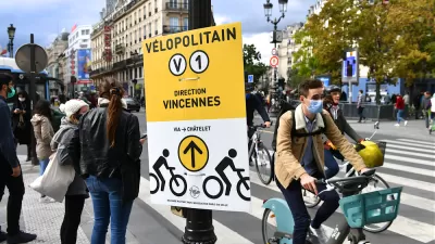
Where Pandemic Bike Improvements Won Out
While some cities are reverting back to pre-pandemic street configurations, others are taking advantage of the momentum for bike and pedestrian infrastructure to make pandemic-era projects permanent.

Alabama: Trump Terminates Settlements for Black Communities Harmed By Raw Sewage
Trump deemed the landmark civil rights agreement “illegal DEI and environmental justice policy.”

Planetizen Federal Action Tracker
A weekly monitor of how Trump’s orders and actions are impacting planners and planning in America.

The 120 Year Old Tiny Home Villages That Sheltered San Francisco’s Earthquake Refugees
More than a century ago, San Francisco mobilized to house thousands of residents displaced by the 1906 earthquake. Could their strategy offer a model for the present?

Ken Jennings Launches Transit Web Series
The Jeopardy champ wants you to ride public transit.

BLM To Rescind Public Lands Rule
The change will downgrade conservation, once again putting federal land at risk for mining and other extractive uses.

Indy Neighborhood Group Builds Temporary Multi-Use Path
Community members, aided in part by funding from the city, repurposed a vehicle lane to create a protected bike and pedestrian path for the summer season.
Urban Design for Planners 1: Software Tools
This six-course series explores essential urban design concepts using open source software and equips planners with the tools they need to participate fully in the urban design process.
Planning for Universal Design
Learn the tools for implementing Universal Design in planning regulations.
Clanton & Associates, Inc.
Jessamine County Fiscal Court
Institute for Housing and Urban Development Studies (IHS)
City of Grandview
Harvard GSD Executive Education
Toledo-Lucas County Plan Commissions
Salt Lake City
NYU Wagner Graduate School of Public Service