


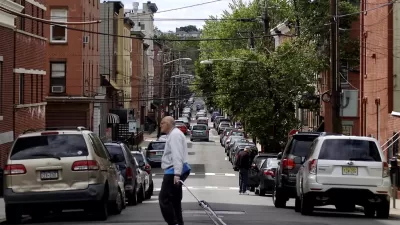
As city planners we are increasingly recording, measuring, and organizing city data—a practice known as urban science. Learn about resources across the globe helping to better understand our cities.


I recently traveled to Glasgow, Scotland with students and faculty from around the world learning about Cities and Citizens in the Digital Age. The sessions were wonderful, and I am sharing installments about a number of the key sessions of interest to the Planetizen community.
As city planners we are increasingly recording, measuring, and organizing city data—a practice known as urban science. Urban science is increasing in importance and universities across the globe are focusing on urban problems through urban science. Dr. Chris Pettit, a professor of Urban Science at the University of New South Wales, shared a range of labs and resources that are analyzing cities. Below is a list of resources offering insight and access into this emerging field. I encourage you to spend some time clicking through these websites—there is lots of planner eye candy, from gorgeous maps to fascinating city facts.
Australian Urban Research Infrastructure Network: AURIN is a national collaborative delivering e-research infrastructure to empower better decisions for Australia's urban settlements and their future development.
Beijing City Lab: The Beijing City Lab employs interdisciplinary methods to quantify urban dynamics, generating new insights for urban planning and governance and ultimately producing the science of cities required for sustainable urban development.
Center for Advanced Spatial Analysis: This center is a leading force in the science of cities, generating new knowledge and insights for use in city planning, policy, and design—drawing on the latest geospatial methods and ideas in computer-based visualization and modeling.
Center for Urban Science and Progress: The Center for Urban Science and Progress is a public-private research center that uses New York as its laboratory to help cities around the world become more productive, livable, equitable, and resilient.
Future Cities Laboratory: The Future Cities Laboratory focuses on sustainable urbanization on different scales in a global context.
The Programmable City Project: The Programmable City Project examines software-enabled technologies and services to augment and facilitate how we understand and plan cities, how we manage urban services and utilities, and how we live urban lives.
Senseable City Lab: The Senseable City Lab deploys sensors and hand-held electronics to study the build environment.
SustainCity: SustainCity addresses the modeling and computational issues of integrating modern mobility simulations with the latest micro-simulation land use models.
Urban Big Data Centre: The Urban Big Data Center is a resource promoting the use of innovative methods and complex urban data to solve global problems.
Urban Observatory: The Urban Observatory is an interactive app and website that allow people to compare and contrast cities from around the world. This of this as a "live museum with a data pulse."
Warwick Institute for the Science of Cities: WISC focuses on the means to gather city-scale data and the apparatus to transform this data into knowledge, capitalizing on emerging developments in big data and in interdisciplinary solutions to the world's urban challenges.


An Expanded Approach to the Analysis of Cities
Even with so much data in the world, cities are a slippery subject. What if an everyday part of life in cities—the "scenes" comprised by businesses, people, and practices of similarly distinct aesthetics—can help our understanding?
Hoboken's Curbs Are Going Digital
Hoboken, New Jersey, is leveraging technology to up its curb management game with a digital streetscape map that will allow real-time demand monitoring.
Tech Trends for Cities and States
Smart cities technology is well behind schedule, but the technology industry hasn’t given up on new digital solutions, self-driving cars, curb management, and AI-powered systems.

Alabama: Trump Terminates Settlements for Black Communities Harmed By Raw Sewage
Trump deemed the landmark civil rights agreement “illegal DEI and environmental justice policy.”

Study: Maui’s Plan to Convert Vacation Rentals to Long-Term Housing Could Cause Nearly $1 Billion Economic Loss
The plan would reduce visitor accommodation by 25% resulting in 1,900 jobs lost.

Planetizen Federal Action Tracker
A weekly monitor of how Trump’s orders and actions are impacting planners and planning in America.

Waymo Gets Permission to Map SF’s Market Street
If allowed to operate on the traffic-restricted street, Waymo’s autonomous taxis would have a leg up over ride-hailing competitors — and counter the city’s efforts to grow bike and pedestrian on the thoroughfare.

Parklet Symposium Highlights the Success of Shared Spaces
Parklets got a boost during the Covid-19 pandemic, when the concept was translated to outdoor dining programs that offered restaurants a lifeline during the shutdown.

Federal Homelessness Agency Places Entire Staff on Leave
The U.S. Interagency Council on Homelessness is the only federal agency dedicated to preventing and ending homelessness.
Urban Design for Planners 1: Software Tools
This six-course series explores essential urban design concepts using open source software and equips planners with the tools they need to participate fully in the urban design process.
Planning for Universal Design
Learn the tools for implementing Universal Design in planning regulations.
Caltrans
Smith Gee Studio
Institute for Housing and Urban Development Studies (IHS)
City of Grandview
Harvard GSD Executive Education
Toledo-Lucas County Plan Commissions
Salt Lake City
NYU Wagner Graduate School of Public Service