


Search engines and mobile apps are becoming increasingly localized and personalized, providing recommendations based on who and where we are. These changes have the potential to impact our cities by encouraging people to broaden their experiences.


I am in Glasgow, Scotland with students and faculty from around the world learning about Cities and Citizens in the Digital Age. The sessions have been wonderful, and I will be sharing installments about a number of the key sessions of interest to the Planetizen community.
As professionals, we are increasingly looking for analytical tools to better understand what is happening in cities. For example, if a city is interested in the success of redevelopment in a neighborhood, how could they tell whether the neighborhood has more activities this year than in the year before? How do we know if a neighborhood is becoming a popular destination? Beyond our professional interest there is also the personal interest: What new restaurant should I go to? What's the best new art gallery?
Dr. Craig Mac Donald, an information retrieval researcher in the School of Computing Science at the University of Glasgow, spoke on citizen information needs within smart cities. MacDonald is interested in is how search engines can work better. You might have noticed that when you enter a Google search that it increasingly knows what you are looking for by offering auto completion. Sometimes the auto completion seems eerily accurate as to what you were hoping to search for. Currently, 50 percent of Google searches come from a mobile phone. This means that increasingly people are searching for information that is locally focused and timely—such as restaurants nearby.
Now imagine you are at home and you want to go out for the evening. Right now, you can go to yelp or other sites. But these sites do not provide personalized recommendations—they are close by or they meet the criteria of a specific search term.
Personalized and time aware recommendations are just around the corner. Your mobile phone knows your location, day of the week, and the time of day. The phone knows where you have gone before based on previous social media activity—for example check-ins at museums and pages you have liked on Facebook. It is possible based on this combination of information to make a contextual suggestion, offering nearby locations that are most suitable for you.
To see how well this works, MacDonald recruited 100 people in three cities—London, San Francisco, and Amsterdam—and used their model to offer suggestions for users. The Entertain Me mobile app integrates with Foursquare and Facebook to provide venue-centric and time-aware recommendations. Residents picked a neighborhood they would like to go on the app. The app then provides recommendations. Residents found the personalized suggestions were preferred over what they would have found through a normal search.
This could be expanded to integrate weather conditions—if it is sunny or raining it could offer better recommendations.
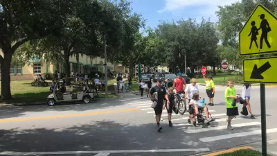
From a city perspective, how would personalized recommendation shape our city? Would it encourage residents to explore more new places in different parts of the city? Would it discourage people from going to less popular neighborhoods? And how could we use increased/decreased checkins to better understand neighborhood change. Would we be able to better understand revitalization or decline?

An App Made for Urban Explorers
The Likeways app offers a "Space Recommender System" that aims to return serendipity to the process of navigating a city.
Best Apps for Urban Planning in 2022
Mobile apps continue to redefine the practices of planning—urban planning, regional planning, transportation planning, community planning, and rural planning included.
Earn Rewards for Traveling for by Foot, Bike, Bus, or Train
The city of Orlando is partnering with the Miles app.

Alabama: Trump Terminates Settlements for Black Communities Harmed By Raw Sewage
Trump deemed the landmark civil rights agreement “illegal DEI and environmental justice policy.”

Planetizen Federal Action Tracker
A weekly monitor of how Trump’s orders and actions are impacting planners and planning in America.

The 120 Year Old Tiny Home Villages That Sheltered San Francisco’s Earthquake Refugees
More than a century ago, San Francisco mobilized to house thousands of residents displaced by the 1906 earthquake. Could their strategy offer a model for the present?

High-Speed Rail Tracker
Smart Cities Dive follows high-speed rail developments around the country

Ken Jennings Launches Transit Web Series
The Jeopardy champ wants you to ride public transit.

BLM To Rescind Public Lands Rule
The change will downgrade conservation, once again putting federal land at risk for mining and other extractive uses.
Urban Design for Planners 1: Software Tools
This six-course series explores essential urban design concepts using open source software and equips planners with the tools they need to participate fully in the urban design process.
Planning for Universal Design
Learn the tools for implementing Universal Design in planning regulations.
Clanton & Associates, Inc.
Jessamine County Fiscal Court
Institute for Housing and Urban Development Studies (IHS)
City of Grandview
Harvard GSD Executive Education
Toledo-Lucas County Plan Commissions
Salt Lake City
NYU Wagner Graduate School of Public Service