


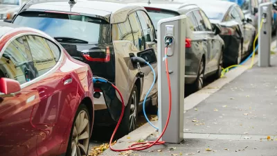
This is what "smart cities" technology looks like: A new product called Inrix Insights offers planners and businesses a platform by which to access the data created by the use of connected cars.
"A new platform that aims to use big data collected from connected cars for better urban planning, retail site selection and advertising measurement has been launched," according to a post by Emily Garthwaite.
Inrix, the company behind the new platform, is a "global transportation and connected car services provider." The new product, Inrix Insights, provides a platform for parsing out and analyzing the data created and gathered by the use of those services. According to Garthwaite, "Businesses and governments could use the platform, which leverages real-time GPS data from a growing network of more than 250 million devices and vehicles, for planning new roads and transit systems, locating a business or measuring the results of marketing campaign." So far the Insights platforms offers two products: Inrix Insight Trips and Inrix Insight Volumes.
Another post by Traffic Technology Today provides more of the nitty gritty of how the platform works.
For those concerned about privacy when using connected cars, as expressed by Jeremy Cato in an October 2014 op-ed, this platform provides just one example of the kind of information that will be accessible to public and private entities as a result of the use of connected cars at scale.
FULL STORY: INRIX launches smart cities platform to exploit connected cars


How Data-Driven Research Is Shaping Sustainable Urban Development
Explore how data-driven research is revolutionizing sustainable urban development, creating smarter, greener, and more resilient cities for the future.
Tech Trends for Cities and States
Smart cities technology is well behind schedule, but the technology industry hasn’t given up on new digital solutions, self-driving cars, curb management, and AI-powered systems.
A Sustainable Future Requires Smart, Data-Driven Public Transport Networks
Devin de Vries, CEO of WhereIsMyTransport, makes the case for new and improved mobility as a tool for sustainability and equitable economic development.

Alabama: Trump Terminates Settlements for Black Communities Harmed By Raw Sewage
Trump deemed the landmark civil rights agreement “illegal DEI and environmental justice policy.”

Planetizen Federal Action Tracker
A weekly monitor of how Trump’s orders and actions are impacting planners and planning in America.

The 120 Year Old Tiny Home Villages That Sheltered San Francisco’s Earthquake Refugees
More than a century ago, San Francisco mobilized to house thousands of residents displaced by the 1906 earthquake. Could their strategy offer a model for the present?

Indy Neighborhood Group Builds Temporary Multi-Use Path
Community members, aided in part by funding from the city, repurposed a vehicle lane to create a protected bike and pedestrian path for the summer season.

Congestion Pricing Drops Holland Tunnel Delays by 65 Percent
New York City’s contentious tolling program has yielded improved traffic and roughly $100 million in revenue for the MTA.

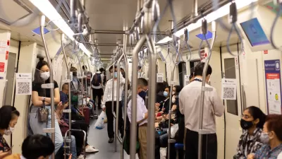
In Both Crashes and Crime, Public Transportation is Far Safer than Driving
Contrary to popular assumptions, public transportation has far lower crash and crime rates than automobile travel. For safer communities, improve and encourage transit travel.
Urban Design for Planners 1: Software Tools
This six-course series explores essential urban design concepts using open source software and equips planners with the tools they need to participate fully in the urban design process.
Planning for Universal Design
Learn the tools for implementing Universal Design in planning regulations.
Clanton & Associates, Inc.
Jessamine County Fiscal Court
Institute for Housing and Urban Development Studies (IHS)
City of Grandview
Harvard GSD Executive Education
Toledo-Lucas County Plan Commissions
Salt Lake City
NYU Wagner Graduate School of Public Service