


A city known for its love of the automobile has been building out its bike network in recent years. The question remains: Is it enough?
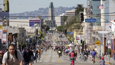
Following an unflattering portrayal of the state of bike infrastructure in Los Angeles, by reporter Aaron Mendelson, the Los Angeles Department of Transportation released new data enabling Mendelson and the KPCC team to create an animated map showing the expansion of the city's bike infrastructure network between the years 2006 and 2015.
First the backstory:
"The LADOT maintains a bike map on its website, but doesn't typically release the raw data behind it to the public. But for this story, the agency shared the latest data—current as of April 1—and we're posting it to Github."
As for what the new data and animated map show: "in 2005, the city of Los Angeles had 245 miles of bike infrastructure: bike lanes, bike paths and streets where drivers are alerted to share the road by bike signs and markings….In the decade since then, the system had more than doubled to 562.25 miles of bike lanes, paths and routes."
Mendelson notes that not all bike infrastructure is created equal, and some parts of the existing network would still likely be deemed unsafe to many potential riders.
FULL STORY: Watch a decade of growth in LA's bike infrastructure

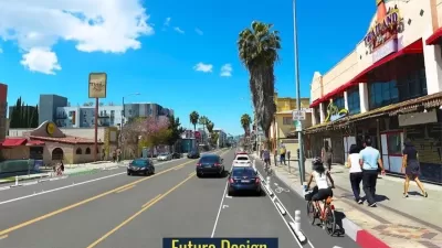
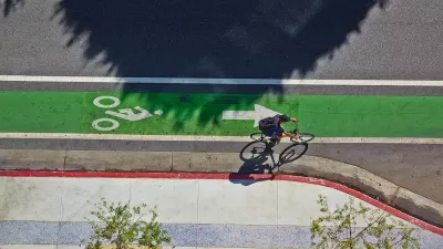
New Bike Lanes Coming to Hollywood Boulevard
Los Angeles is adding 3.6 miles of new protected bike lanes in East Hollywood.

Los Angeles Approves Road Safety Measure
Voters expressed strong support for road safety improvements.
LA’s Mobility Plan Implementation Faces Opposition
The city’s firefighters’ union claims that bike and bus lanes would slow response times and impede access for first responders.

Alabama: Trump Terminates Settlements for Black Communities Harmed By Raw Sewage
Trump deemed the landmark civil rights agreement “illegal DEI and environmental justice policy.”

Planetizen Federal Action Tracker
A weekly monitor of how Trump’s orders and actions are impacting planners and planning in America.

The 120 Year Old Tiny Home Villages That Sheltered San Francisco’s Earthquake Refugees
More than a century ago, San Francisco mobilized to house thousands of residents displaced by the 1906 earthquake. Could their strategy offer a model for the present?

Ken Jennings Launches Transit Web Series
The Jeopardy champ wants you to ride public transit.

BLM To Rescind Public Lands Rule
The change will downgrade conservation, once again putting federal land at risk for mining and other extractive uses.

Indy Neighborhood Group Builds Temporary Multi-Use Path
Community members, aided in part by funding from the city, repurposed a vehicle lane to create a protected bike and pedestrian path for the summer season.
Urban Design for Planners 1: Software Tools
This six-course series explores essential urban design concepts using open source software and equips planners with the tools they need to participate fully in the urban design process.
Planning for Universal Design
Learn the tools for implementing Universal Design in planning regulations.
Clanton & Associates, Inc.
Jessamine County Fiscal Court
Institute for Housing and Urban Development Studies (IHS)
City of Grandview
Harvard GSD Executive Education
Toledo-Lucas County Plan Commissions
Salt Lake City
NYU Wagner Graduate School of Public Service