


It often seems that streetscapes' appearances and forms are immutable, but Los Angeles is trying something new. Through a herculean effort called Recode: LA, Los Angeles is rewriting its codes and, consequently, may change how its streets look.
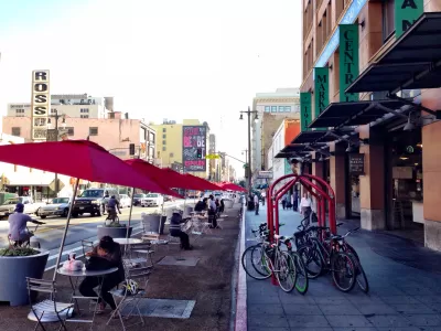
Zoning is often thought of—if it is thought of at all—as a way of regulating the uses and forms of buildings in certain parts of cities. But that’s not all, writes Mark Vallianatos, professor of urban and environmental policy at Occidental College. Zoning can also dictate the fine-grain look and functioning of a city's streets.
For Vallianatos, therefore, some of the shortcomings of Los Angeles' streets are no accident. L.A.'s car-centric, pedestrian-unfriendly streets result from zoning codes implemented in 1946. This means that L.A. has seven decades' worth of outdated streetscape. Fortunately, what was created by code may be redesigned by code. "Revised zoning rules can hopefully strengthen the ways that a 21st century Los Angeles is transforming and help residents build a city where walking is a convenient and safe way to travel," writes Vallianatos. "Zoning is potentially our most powerful tool to create a more walkable Los Angeles."
As the city works on an update to its zoning code through an effort branded as Recode: LA, Vallianatos offers recommendations for reforming the code and creating friendlier streets. They include increases in mixed-use zoning, lowering of minimum parking requirements, and encouraging pedestrian-friendly design.
FULL STORY: ReZoning Los Angeles: Can We Legalize a Walkable City?

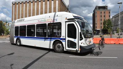
Report: Zoning Reforms Should Complement Nashville’s Ambitious Transit Plan
Without reform, restrictive zoning codes will limit the impact of the city’s planned transit expansion and could exclude some of the residents who depend on transit the most.

How Atlanta Built 7,000 Housing Units in 3 Years
The city’s comprehensive, neighborhood-focused housing strategy focuses on identifying properties and land that can be repurposed for housing and encouraging development in underserved neighborhoods.

San Antonio Remains Affordable as City Grows
The city’s active efforts to keep housing costs down through housing reforms and coordinated efforts among city agencies and developers have kept it one of the most affordable in the nation despite its rapid population growth.

Alabama: Trump Terminates Settlements for Black Communities Harmed By Raw Sewage
Trump deemed the landmark civil rights agreement “illegal DEI and environmental justice policy.”

Planetizen Federal Action Tracker
A weekly monitor of how Trump’s orders and actions are impacting planners and planning in America.

The 120 Year Old Tiny Home Villages That Sheltered San Francisco’s Earthquake Refugees
More than a century ago, San Francisco mobilized to house thousands of residents displaced by the 1906 earthquake. Could their strategy offer a model for the present?

In Both Crashes and Crime, Public Transportation is Far Safer than Driving
Contrary to popular assumptions, public transportation has far lower crash and crime rates than automobile travel. For safer communities, improve and encourage transit travel.

Report: Zoning Reforms Should Complement Nashville’s Ambitious Transit Plan
Without reform, restrictive zoning codes will limit the impact of the city’s planned transit expansion and could exclude some of the residents who depend on transit the most.

Judge Orders Release of Frozen IRA, IIJA Funding
The decision is a victory for environmental groups who charged that freezing funds for critical infrastructure and disaster response programs caused “real and irreparable harm” to communities.
Urban Design for Planners 1: Software Tools
This six-course series explores essential urban design concepts using open source software and equips planners with the tools they need to participate fully in the urban design process.
Planning for Universal Design
Learn the tools for implementing Universal Design in planning regulations.
Clanton & Associates, Inc.
Jessamine County Fiscal Court
Institute for Housing and Urban Development Studies (IHS)
City of Grandview
Harvard GSD Executive Education
Toledo-Lucas County Plan Commissions
Salt Lake City
NYU Wagner Graduate School of Public Service