


In suburbia, the line between smart growth and conventional sprawl is sometimes a blurry one.


In a recent article in the Columbia Journal of Environmental Law, law student Paige Pavone criticizes suburban apartments and condominiums as "green sprawl" because they "merely add density to suburban sprawl and exacerbate the very problems smart growth seeks to correct." She explains that without public infrastructure to support walking and biking, these developments merely entice more people into car-dependent suburbia, and therefore should not be entitled to density bonuses and other incentives that a state might use to encourage smart growth. In particular, she claims that such "High-Density Islands" are cut off from "communities, local governments, nature, public transportation, and sidewalks."
Is this critique fair? Somewhat.
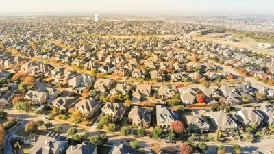
Pavone examined a variety of suburban multifamily developments, but focuses on Reading Woods, in Reading, Massachusetts, a suburb of Boston. She claims that Reading Woods residents "cannot walk to the public library, a bank, or a grocery store" and would have to cross I-95 to reach a chain restaurant. So I decided to look at Reading Woods on Google Street View and see how horrible it is.
First of all, I looked for sidewalks. The main street serving Reading Woods is Jacob Way. Jacob Way generally has sidewalks, as does Augustus Court (the main street serving the part of Reading Woods further away from South). So it seems to me that a resident of Reading Woods can use sidewalks for most visits to South Street and other neighborhood streets. To reach Main Street (the neighborhood’s main commercial street) you must walk briefly on South Street, which also has a sidewalk (though it only serves one side of the street, and looks pretty narrow).
By contrast, I have seen multifamily dwellings (especially in the South) that do far less to accommodate pedestrians. For example, if you go to Calibre Brooke Way in Smyrna, Georgia you will see an apartment rental office, and you will see a long driveway leading to apartments—but what you will not see is a sidewalk. The designers of the Calibre Brooke apartments seem to have assumed that every resident would either drive everywhere or be perfectly content to share the driveway with cars. Compared to Calibre Brooke, Reading Woods is downright pedestrian-friendly.
Second, I looked for destinations within walking distance. Even if the residents of Jacob Way have a sidewalk, what can they walk to? Here too, they do better than many suburbanites. The walkscore of Jacob Way is a mediocre 47. Although Reading Woods residents cannot walk to everything, they can walk to quite a few things, even without crossing the highway. The commercial street nearest to Reading Woods is Main Street. Walkscore tells me that on the Jacob Way side of I-95, there are five restaurants on Main Street within a mile of Reading Woods, including a Burger King, a Domino’s and a few non-chain restaurants. In addition, there is an ATM, a fruit store, and some other small stores. Of course, there are additional delights for those foolhardly enough to walk under the I-95 underpass.
The part of Main Street closest to Jacob Way seems to me adequate but not great from a pedestrian perspective: there are sidewalks on both sides of the street, and four lanes, more than I would like but fewer than in much of suburbia.
On the negative side, much of Reading’s civic equipment is roughly one to two miles away—too far, I suspect, for many people to walk in Massachusetts weather. The nearest full-service grocery stores seem to be just over a mile away, and the public library and City Hall area both almost two miles away.
Third, I looked for public transit. If you can’t walk to the public library or city hall, can you take a bus or train there? Reading Woods is 1.3 miles from the Reading commuter train station—walking distance for an able-bodied person in good weather, but not for everyone and not in today's weather conditions. Unfortunately, bus service is Reading Woods’s Achilles' heel: the closest bus stop is on the other side of the highway, not significantly closer than the train station, and only runs until 7 pm on weekdays and not at all on Sundays. I can’t say that I would like to live there; on the other hand, compared to Kansas City’s western suburbs (where buses stop running around 5 pm and rail transit is a pipe dream), Reading Woods does not look so bad.
So do high-density islands such as Reading Woods increase societal walkability, or do they merely add density to suburban sprawl? I think the right answer is a question: "Compared to what?" Compared to the city of Boston or to close-in suburbs like Brookside, Reading Woods is mediocre at best. But compared to the outer suburbs of the South or Midwest, Reading Woods does not look so terrible.
So should government do anything to encourage housing in places like Reading Woods? From a smart growth perspective, Reading Woods is better than some further-out suburbs but still pretty mediocre. Ideally, a wise government would permit enough housing in closer-in communities to sate public demand for apartments affordable to the middle and lower classes.
On the other hand, Boston is a pretty expensive market, and it may not be politically possible to bring down rents without creating new units in places like Reading Woods. So I guess my answer is: "It depends."


The Natalist Case For Sprawl (And Why It Fails)
Some commentators defend anti-urban government policies such as exclusionary zoning on the basis that homeowning suburbanites have high birth rates. But this doesn't seem to be true in recent decades.
Zoning for Good
A new book highlights the power of zoning to change communities for the better.

First Model Homes Revealed in Disney-Built Community
Disney’s Cotino, in the Southern California desert, is the first of the company’s ‘Storybook Living’ developments.

Alabama: Trump Terminates Settlements for Black Communities Harmed By Raw Sewage
Trump deemed the landmark civil rights agreement “illegal DEI and environmental justice policy.”

Study: Maui’s Plan to Convert Vacation Rentals to Long-Term Housing Could Cause Nearly $1 Billion Economic Loss
The plan would reduce visitor accommodation by 25% resulting in 1,900 jobs lost.

Planetizen Federal Action Tracker
A weekly monitor of how Trump’s orders and actions are impacting planners and planning in America.

Waymo Gets Permission to Map SF’s Market Street
If allowed to operate on the traffic-restricted street, Waymo’s autonomous taxis would have a leg up over ride-hailing competitors — and counter the city’s efforts to grow bike and pedestrian on the thoroughfare.

Parklet Symposium Highlights the Success of Shared Spaces
Parklets got a boost during the Covid-19 pandemic, when the concept was translated to outdoor dining programs that offered restaurants a lifeline during the shutdown.

Federal Homelessness Agency Places Entire Staff on Leave
The U.S. Interagency Council on Homelessness is the only federal agency dedicated to preventing and ending homelessness.
Urban Design for Planners 1: Software Tools
This six-course series explores essential urban design concepts using open source software and equips planners with the tools they need to participate fully in the urban design process.
Planning for Universal Design
Learn the tools for implementing Universal Design in planning regulations.
Caltrans
Smith Gee Studio
Institute for Housing and Urban Development Studies (IHS)
City of Grandview
Harvard GSD Executive Education
Toledo-Lucas County Plan Commissions
Salt Lake City
NYU Wagner Graduate School of Public Service