


The popular navigation app Waze includes a feature that rewards users for revealing the location of police officers. A debate over the public safety impacts of that feature is gaining traction, and some police officers want the feature removed.
Fidel Martinez reports on a growing coalition that opposes the use of a feature from one of the darlings of the mobile apps scene—Waze. The feature in questions allows users to report the location of police. Here's how Martinez sums up the viewpoint of the police that support the feature's removal from the app:
"For those who live in a congested city with poor city planning, Waze is a godsend. For police officers, however, the popular app is putting their lives at risk."
As Martinez explains, the movement to remove the feature of the app that allows users to report the location of police officers is led by Sergio Kopelev, "a reserve deputy for the Orange County Sheriff’s Department who spent many years running the cybercrimes unit for the Bedford County Sheriff’s Office in Virginia."
Koplev is citied in the article, making his case against the Waze feature: "'When you pin an officer’s location, you don’t know who you’re broadcasting that information to,' Kopelev explained. He cited how Ismaaiyl Brinsley had allegedly posted a screengrab of him using Waze to track police movement before killing NYPD officers Wenjian Liu and Rafael Ramos."
FULL STORY: Cops want Waze to get rid of its police-tracking feature

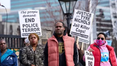
Memphis: Crime-fighting Camera Sheds Light on Police Abuse
The irony is unmistakable. Public surveillance cameras, long controversial in the criminal justice community, provided pivotal video footage of the beating of motorist Tyre Nichols by five Memphis police officers at a traffic stop on January 7.
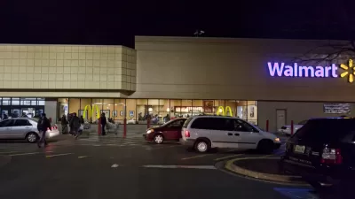
Investigation: Walmarts Abuse Local Police Force Resources
An investigation by the Tampa Bay Times finds Walmart stores treating local police forces like their own personal security forces.
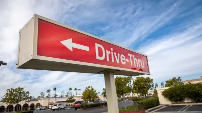
The Resurgence of Drive-Throughs
Dining areas in many fast food restaurants are being replaced with added drive-thru lanes, another post-pandemic impact on our lives benefiting those with four wheels (or more).

Alabama: Trump Terminates Settlements for Black Communities Harmed By Raw Sewage
Trump deemed the landmark civil rights agreement “illegal DEI and environmental justice policy.”

Planetizen Federal Action Tracker
A weekly monitor of how Trump’s orders and actions are impacting planners and planning in America.

The 120 Year Old Tiny Home Villages That Sheltered San Francisco’s Earthquake Refugees
More than a century ago, San Francisco mobilized to house thousands of residents displaced by the 1906 earthquake. Could their strategy offer a model for the present?

Ken Jennings Launches Transit Web Series
The Jeopardy champ wants you to ride public transit.

BLM To Rescind Public Lands Rule
The change will downgrade conservation, once again putting federal land at risk for mining and other extractive uses.

Indy Neighborhood Group Builds Temporary Multi-Use Path
Community members, aided in part by funding from the city, repurposed a vehicle lane to create a protected bike and pedestrian path for the summer season.
Urban Design for Planners 1: Software Tools
This six-course series explores essential urban design concepts using open source software and equips planners with the tools they need to participate fully in the urban design process.
Planning for Universal Design
Learn the tools for implementing Universal Design in planning regulations.
Clanton & Associates, Inc.
Jessamine County Fiscal Court
Institute for Housing and Urban Development Studies (IHS)
City of Grandview
Harvard GSD Executive Education
Toledo-Lucas County Plan Commissions
Salt Lake City
NYU Wagner Graduate School of Public Service