


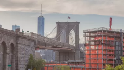
New analysis from Richard Florida and the Martin Prosperity Institute maps segregation by employment type, finding the darker effects of the creative class.

Emily Badger shares insight into new analysis by Richard Florida and the Martin Prosperity Institute that uses American Community Survey data to map the types of occupations held by residents of American cities. The analysis produces findings that expand beyond traditional understandings of segregation as measured merely by income level, according to Badger:
Their results point to a different picture of socioeconomic segregation in American cities — one divided more explicitly by the nature and type of work we do, rather than how much money we make doing it — than we're used to discussing.
The analysis separates workers into three classes, derived from Florida's research: "creative class," "service class," and "working class." Among the observations Badger provides in her take is that the 12 surveyed cities have retained "strikingly few working-class strongholds."
The study was released today, timed for the second annual CityLab conference in Los Angeles. Florida has also provided his own take on the study.
FULL STORY: Mapped: How the ‘creative class’ is dividing U.S. cities


Cities Have Doubled in Size Globally in the Last 20 Years, Study Says
New research from China finds an incredible rate of urban expansion in North America and China.
As Cities Have Changed, So Have Richard Florida's Ideas
Call it the re-education, the evolution, or the contrition of Richard Florida, but the "rock-star urbanist" has realized some unintended consequences of his creative class ethos, and he's ready to share a new vision for cities.

What 6,000 Years of Population Data Looks Like
We can now watch 6,000 years of urban settlements and movements unfold on our computer screens.

Alabama: Trump Terminates Settlements for Black Communities Harmed By Raw Sewage
Trump deemed the landmark civil rights agreement “illegal DEI and environmental justice policy.”

Planetizen Federal Action Tracker
A weekly monitor of how Trump’s orders and actions are impacting planners and planning in America.

The 120 Year Old Tiny Home Villages That Sheltered San Francisco’s Earthquake Refugees
More than a century ago, San Francisco mobilized to house thousands of residents displaced by the 1906 earthquake. Could their strategy offer a model for the present?

Ken Jennings Launches Transit Web Series
The Jeopardy champ wants you to ride public transit.

BLM To Rescind Public Lands Rule
The change will downgrade conservation, once again putting federal land at risk for mining and other extractive uses.

Indy Neighborhood Group Builds Temporary Multi-Use Path
Community members, aided in part by funding from the city, repurposed a vehicle lane to create a protected bike and pedestrian path for the summer season.
Urban Design for Planners 1: Software Tools
This six-course series explores essential urban design concepts using open source software and equips planners with the tools they need to participate fully in the urban design process.
Planning for Universal Design
Learn the tools for implementing Universal Design in planning regulations.
Clanton & Associates, Inc.
Jessamine County Fiscal Court
Institute for Housing and Urban Development Studies (IHS)
City of Grandview
Harvard GSD Executive Education
Toledo-Lucas County Plan Commissions
Salt Lake City
NYU Wagner Graduate School of Public Service